Back هاريدوار Arabic Хардвар Byelorussian हरिद्वार Bihari হরিদ্বার Bengali/Bangla হরদুৱার BPY Hardwar Catalan Haridwar (lungsod) CEB Haridvár Czech Haridwar German हरिद्वार DTY
Haridwar
Mayapuri | |
|---|---|
|
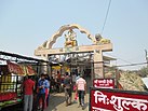
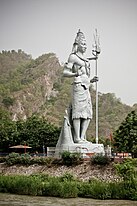
Clockwise from top: Evening view of Har Ki Pauri, Chandi Devi Temple, Ropeway to Chandi Devi, view of the Ganga River, Haridwar railway station, Ganga Aarti at Har Ki Pauri, Shiv Murti during sunset and the Mansa Devi Temple. | |
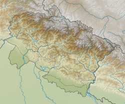
| Coordinates: 29°56′42″N 78°09′47″E / 29.945°N 78.163°E | |
| Country | |
| State | Uttarakhand |
| District | Haridwar |
| Municipality | 1868 |
| Government | |
| • Type | Mayor–Council |
| • Body | Haridwar Municipal Corporation |
| • Mayor | Anita Sharma (INC) |
| • Municipal Commissioner | Alok Kumar Pandey, IAS |
| Area | |
| • City | 105 km2 (41 sq mi) |
| Elevation | 314 m (1,030 ft) |
| Population (2011)[2] | 228,832[1] |
| • Metro | 231,338 |
| Languages | |
| • Official | Hindi |
| • Native | Khariboli |
| Time zone | UTC+5:30 (IST) |
| PIN | 249401 |
| Telephone code | +91-1334 |
| Vehicle registration | UK-08 |
| Sex ratio | 1.18[2] ♂/♀ |
| Website | haridwar |
Haridwar (/hʌrɪˈdwɑːr/; Hindi: [ɦəɾɪd̪waːɾ] ; formerly Mayapuri[3]) is a city and municipal corporation in the Haridwar district of Uttarakhand, India. With a population of 228,832 in 2011, it is the second-largest city in the state and the largest in the district.[4]
The city is situated on the right bank of the Ganges river, at the foothills of the Shivalik ranges. Haridwar lies in doab region where people speak khari boli.[5] Haridwar is regarded as a holy place for Hindus, hosting important religious events and serving as a gateway to several prominent places of worship. Most significant of the events is the Kumbha Mela, which is celebrated every 12 years in Haridwar. During the Haridwar Kumbh Mela, millions of pilgrims, devotees, and tourists congregate in Haridwar to perform ritualistic bathing on the banks of the Ganges to wash away their sins to attain moksha.
According to Puranic legend, Haridwar, along with Ujjain, Nashik, and Prayag, is one of four sites where drops of amrita,[6] the elixir of immortality, accidentally spilled over from a kumbha (pitcher) while being carried by the celestial bird Garuda during the Samudra Manthana, or the churning of the ocean of milk.[7] Brahma Kund, the spot where the amrita fell, is believed to be located at Har ki Pauri (literally, "footsteps of the Lord") and is considered to be the most sacred ghat of Haridwar.[8] It is also the primary centre of the Kanwar pilgrimage, in which millions of participants gather sacred water from the Ganges and carry it across hundreds of miles to dispense as offerings in Shiva shrines.[9] Today, the city is developing beyond its religious importance with the fast-developing industrial estate of the State Industrial Development Corporation of Uttarakhand (SIDCUL), and the close by township of Bharat Heavy Electricals Limited (BHEL), as well as its affiliated ancillaries.
Haridwar presents a kaleidoscope of Indian culture and development. In sacred writings, it has been differently specified as Kapilsthan, Gangadwar and Mayapuri. It is additionally a passage for the Chota Char Dham (the four principal pilgrim destinations in Uttarakhand).
- ^ Hardwar Population Census 2011
- ^ a b "haridwar City Population Census of India, 2011". Office of the Registrar General, India. 2 March 2002. Retrieved 23 August 2015.
- ^ "History | District Haridwar, Government of Uttarakhand | India". Retrieved 11 March 2023.
- ^ "District Census Handbook, Hardwar" (PDF). censusindia.gov.in. 29 January 2011. Retrieved 29 January 2011.
- ^ "District Census Handbook, Hardwar". Census of India 2011: 5–7. 29 January 2011.
- ^ "इस पौराणिक कथा से जानिए क्यों लगता है कुंभ का मेला? – mobile". punjabkesari. 4 February 2021. Retrieved 13 November 2021.
- ^ Cite error: The named reference
sahajawas invoked but never defined (see the help page). - ^ Gopal, Madan (1990). K.S. Gautam (ed.). India through the ages. Publication Division, Ministry of Information and Broadcasting, Government of India. p. 178.
- ^ Singh, Vikash (2017). Uprising of the Fools. Stanford University Press. ISBN 9781503601673.


