Back Huangchuan Xian CEB Huangchuan German Huangchuan Spanish شهرستان هوانگچوان Persian Xian de Huangchuan French County Huangchuan ID Contea di Huangchuan Italian 潢川県 Japanese 황촨현 Korean Huangchuan NB
Huangchuan County
潢川县 Hwangchwan | |
|---|---|
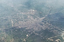
 Aerial view of Huangchuan | |
| Coordinates: 32°08′13″N 115°02′52″E / 32.13694°N 115.04778°E | |
| Country | People's Republic of China |
| Province | Henan |
| Prefecture-level city | Xinyang |
| Settled | c. 21st century BC |
| - Yiyang County | 206 BC |
| - Guangzhou | 712 AD |
| - Huangchuan | 1913 AD |
| Government | |
| • Secretary | vacancy (CPC) |
| • Magistrate | Zhao Liang |
| Area | |
| • County | 1,638 km2 (632 sq mi) |
| • Water | 107 km2 (41 sq mi) |
| • Metro | 33.4 km2 (12.9 sq mi) |
| Dimensions | |
| • Length | 53 km (33 mi) |
| • Width | 44.5 km (27.7 mi) |
| Elevation | 45 m (148 ft) |
| Highest elevation | 330 m (1,080 ft) |
| Lowest elevation | 30 m (100 ft) |
| Population (2019)[1] | |
| • County | 676,500 |
| • Density | 410/km2 (1,100/sq mi) |
| • Metro | 280,000 |
| • Metro density | 8,400/km2 (22,000/sq mi) |
| Time zone | UTC+8 (China Standard) |
| Postal code | 465150 |
| Area code | 376 |
| ISO 3166 code | CN-41-11-25 |
| Licence plate prefix | 豫S3 |
| Website | www |
Huangchuan County (simplified Chinese: 潢川县; traditional Chinese: 潢川縣; pinyin: Huángchuān Xiàn; local pronunciation: Huāngchuǎn Xiàn) is a county of southeastern Henan province, People's Republic of China. It is located in the center of Xinyang City, straddling the Huang River.
The 13th five-year plan of Xinyang City proposes to support the withdrawal of Huangchuan County to apply for the construction of Guangzhou City, build a sub central city in the city area, and accelerate the integrated development of Huangchuan and Guangshan.[3]
- ^ a b 最新人口信息 www.hongheiku.com (in Chinese). hongheiku. Retrieved 2021-01-12.
- ^ a b Cite error: The named reference
信阳基本地理信息分析was invoked but never defined (see the help page). - ^ "信阳市国民经济和社会发展第十三个五年规划纲要 - 信阳市发展和改革委员会". www.xydrc.gov.cn. Archived from the original on 2019-03-07. Retrieved 2019-11-21.
