Back ايكى ARZ İki adası Azerbaijani Ікі Byelorussian Ikino Shima CEB دوورگەی ئیکی CKB Iki (ostrov) Czech Iki (Insel) German Isla Iki Spanish Iki saar Estonian Iki uhartea Basque
This article needs additional citations for verification. (May 2023) |
This Geology needs attention from an expert in Volcanoes. Please add a reason or a talk parameter to this template to explain the issue with the Geology
. (May 2023) |
Native name: 壱岐島, Iki-no-shima, Iki rettō | |
|---|---|
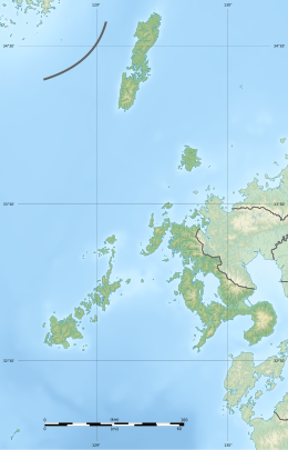
 Map of Iki-no-shima | |
 Map of Nagasaki Prefecture with Iki Islands in red | |
| Geography | |
| Coordinates | 33°47′N 129°43′E / 33.783°N 129.717°E |
| Adjacent to | Tsushima Strait |
| Total islands | 4 inhabited, 18 total |
| Area | 138.46 km2 (53.46 sq mi) |
| Highest elevation | 212.9 m (698.5 ft) |
| Highest point | Takenotsuji |
| Administration | |
| Prefectures | Nagasaki |
| City | Iki |
| Demographics | |
| Population | 28,008 (2013) |
| Pop. density | 202/km2 (523/sq mi) |
| Ethnic groups | Japanese |

Iki Island (壱岐島, Iki-no-shima), or the Iki Archipelago (壱岐諸島, Iki-shotō), is an archipelago in the Tsushima Strait,[1] which is administered as the city of Iki in Nagasaki Prefecture, Japan. The islands have a total area of 138.46 square kilometres (53.46 sq mi) with a total population of 28,008. Only four (4) of the twenty-three (23) named islands are permanently inhabited. Together with the neighboring islands of Tsushima, they are collectively within the borders of the Iki–Tsushima Quasi-National Park.[2]
- ^ "Iki | island, Japan | Britannica". www.britannica.com. Retrieved 2023-05-09.
- ^ "Iki-Tsushima Quasi-National Park Travel Guide: Tourist Attractions & Things to Do". Trek Zone. Retrieved 2023-05-10.

