Back ممر الينوى المائى ARZ Illinois Waterway German Illinois Waterway French נתיב המים אילינוי HE ილინოისის არხი Georgian Ilinojaus vandens kelias Lithuanian ഇല്ലിനോയി വാട്ടർവേ Malayalam Illinois Waterway Dutch Иллинойсский водный путь Russian Іллінойський водний шлях Ukrainian
| Illinois Waterway | |
|---|---|
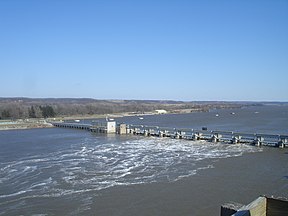
 The Illinois Waterway at Starved Rock Lock and Dam | |
 Historical map of the I&M Canal. While later construction would create the Illinois Waterway, it generally follows a similar route as shown in the inset. | |
| Location | Northern / Central Illinois |
| Country | United States |
| Specifications | |
| Length | 336 miles (541 km) |
| Maximum boat draft | 9 feet (2.7 m) |
| Locks | 8 |
| Total rise | 158 feet (48 m) |
| Status | Open |
| Navigation authority | U.S. Army Corps of Engineers |
| Geography | |
| Start point | Lake Michigan |
| End point | Mississippi River |
| Connects to | Great Lakes Waterway |
The Illinois Waterway system consists of 336 miles (541 km) of navigable water from the mouth of the Calumet River at Chicago to the mouth of the Illinois River at Grafton, Illinois. Based primarily on the Illinois River, it is a system of rivers, lakes, and canals that provide a shipping connection from the Great Lakes to the Gulf of Mexico via the Illinois and Mississippi rivers.
The Illinois and Michigan Canal (I&M) opened in 1848. In 1900, the Chicago Sanitary and Ship Canal replaced the I&M and reversed the flow of the Chicago River so it no longer flowed into Lake Michigan. The United States Army Corps of Engineers maintains a 9-foot-deep (2.7 m) navigation channel in the waterway.[1] The waterway's complex northern section is referred to in various contexts for study and management as the Chicago Area Waterway System (CAWS).
Cargoes include bulk commodities, such as coal, chemicals, and petroleum, as well as corn, soybeans and other agricultural products. During some winters, ice floes, especially around the locks and dams, occasionally prevent navigation on the Waterway.
- ^ United States Army Corps of Engineers. "Chapter 6. The Illinois Waterway Archived 2011-07-09 at the Wayback Machine". page 3. June 3, 2005. (Dead link)