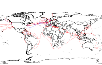
Internet GIS, or Internet geographic information system (GIS), is a term that refers to a broad set of technologies and applications that employ the Internet to access, analyze, visualize, and distribute spatial data.[1][2][3][4][5] Internet GIS is an outgrowth of traditional GIS, and represents a shift from conducting GIS on an individual computer to working with remotely distributed data and functions.[1] Two major issues in GIS are accessing and distributing spatial data and GIS outputs.[6] Internet GIS helps to solve that problem by allowing users to access vast databases impossible to store on a single desktop computer, and by allowing rapid dissemination of both maps and raw data to others.[7][6] These methods include both file sharing and email. This has enabled the general public to participate in map creation and make use of GIS technology.[8][9]
Internet GIS is a subset of Distributed GIS, but specifically uses the internet rather than generic computer networks. Internet GIS applications are often, but not exclusively, conducted through the World Wide Web (also known as the Web), giving rise to the sub-branch of Web GIS, often used interchangeably with Internet GIS.[10][11][12][4][5] While Web GIS has become nearly synonymous with Internet GIS to many in the industry, the two are as distinct as the internet is from the World Wide Web.[13][14][15] Likewise, Internet GIS is as distinct from distributed GIS as the Internet is from distributed computer networks in general.[1][4][5]

Internet GIS includes services beyond those enabled by the Web. Use of any other internet-enabled services to facilitate GIS functions, even if used in conjuncture with the Web, represents the use of Internet GIS.[4][5] One of the most common applications of a distributed GIS system, accessing remotely saved data, can be done through the internet without the need for the Web.[4][5] This is often done in practice when data are sensitive, such as hospital patient data and research facilities proprietary data, where sending data through the Web may be a security risk. This can be done using a Virtual private network (VPN) to access a local network remotely.[16] The use of VPN for these purposes surged during the COVID-19 pandemic, when employers needed to allow employees using GIS access to sensitive spatial data from home.[17][18][19]
- ^ a b c Peng, Zhong-Ren; Tsou, Ming-Hsiang (2003). Internet GIS: Distributed Information Services for the Internet and Wireless Networks. Hoboken, NJ: John Wiley and Sons. ISBN 0-471-35923-8. OCLC 50447645.
- ^ Moretz, David (2008). "Internet GIS". In Shekhar, Shashi; Xiong, Hui (eds.). Encyclopedia of GIS. New York: Springer. pp. 591–596. doi:10.1007/978-0-387-35973-1_648. ISBN 978-0-387-35973-1. OCLC 233971247.
- ^ Zhang, Chuanrong; Zhao, Tian; Li, Weidong (2015). Geospatial Semantic Web. Cham: Springer. doi:10.1007/978-3-319-17801-1. ISBN 978-3-319-17800-4. OCLC 911032733. S2CID 63154455.
- ^ a b c d e Ezekiel, Kuria; Kimani, Stephen; Mindila, Agnes (June 2019). "A Framework for Web GIS Development: A Review". International Journal of Computer Applications. 178 (16): 6–10. doi:10.5120/ijca2019918863. S2CID 196200139.
- ^ a b c d e Rowland, Alexandra; Folmer, Erwin; Beek, Wouter (2020). "Towards Self-Service GIS—Combining the Best of the Semantic Web and Web GIS". ISPRS International Journal of Geo-Information. 9 (12): 753. doi:10.3390/ijgi9120753.
- ^ a b DeMers, Michael (2009). Fundamentals of Geographic Information Systems (4 ed.). Wiley.
- ^ Plewe, Brandon (1997). GIS Online: INFORMATION RETRIEVAL, MAPPING, AND THE INTERNET (1 ed.). OnWord Press. ISBN 1-56690-137-5.
- ^ Hansen, Henning Sten (November 2005). "Citizen participation and Internet GIS—Some recent advances". Computers, Environment and Urban Systems. 29 (6): 617–629. doi:10.1016/j.compenvurbsys.2005.07.001. Retrieved 6 January 2023.
- ^ Cite error: The named reference
Plew2was invoked but never defined (see the help page). - ^ Fu, Pinde; Sun, Jiulin (2011). Web GIS: Principles and Applications. Redlands, Calif.: ESRI Press. ISBN 978-1-58948-245-6. OCLC 587219650.
- ^ Fu, Pinde (2016). Getting to Know Web GIS (2 ed.). Redlands, Calif.: ESRI Press. ISBN 9781589484634. OCLC 928643136.
- ^ Peterson, Michael P. (2014). Mapping in the Cloud. New York: The Guiford Press. ISBN 978-1-4625-1041-2. OCLC 855580732.
- ^ Mathiyalagan, V.; Grunwald, S.; Reddy, K.R.; Bloom, S.A. (April 2005). "A WebGIS and geodatabase for Florida's wetlands". Computers and Electronics in Agriculture. 47 (1): 69–75. doi:10.1016/j.compag.2004.08.003. Retrieved 31 January 2023.
- ^ Veenendaal, Bert; Brovelli, Maria Antonia; Li, Songnian (October 2017). "Review of Web Mapping: Eras, Trends and Directions". ISPRS International Journal of Geo-Information. 6 (10): 317. doi:10.3390/ijgi6100317. hdl:11311/1045866.
- ^ Hojaty, Majid (21 February 2014). "What is the Difference Between Web GIS and Internet GIS?". GIS Lounge. Retrieved 30 August 2022.
- ^ Maile, McCann; Rob, Watts. "What Is A VPN Used For? 9 VPN Uses In 2022". Forbes Advisor. Retrieved 24 December 2022.
- ^ McCarthy, Niall. "VPN Usage Surges During COVID-19 Crisis [Infographic]". Forbes. Retrieved 24 December 2022.
- ^ Skahill, Jeffrey (April 2020). "Tips for Leading a Remote Team during Covid-19". GIS Lounge. Retrieved 24 December 2022.
- ^ "Five Reasons GIS Users Should Use a VPN". gisuser. 4 October 2021. Retrieved 24 December 2022.
