Back نهر جيلوم Arabic نهر جيلم ARZ جهلم چایی AZB Джэлам Byelorussian Джелам Bulgarian झेलम नदी Bihari বিতস্তা নদী Bengali/Bangla Riu Jhelum Catalan Jhelum River CEB ڕووباری جێھلۆم CKB
| Jhelum | |
|---|---|
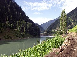
 Jhelum River photographed in Pakistan, c. 2006 | |
| Location | |
| Countries | India, Pakistan |
| Physical characteristics | |
| Source | |
| • location | Verinag Spring |
| • coordinates | 33°32′05″N 75°14′59″E / 33.53472°N 75.24972°E |
| Mouth | |
• location | Chenab River at Trimmu, Jhang District |
• coordinates | 31°10′N 72°09′E / 31.17°N 72.15°E |
| Length | 725 km (450 mi) |
| Discharge | |
| • average | 1,026.6 m3/s (36,250 cu ft/s) (near Mangla Dam) |
| • minimum | 234.19 m3/s (8,270 cu ft/s) (near Mangla Dam) |
| • maximum | 26,419.13 m3/s (932,983 cu ft/s) (near Mangla Dam) |
| Discharge | |
| • average | 313.19 m3/s (11,060 cu ft/s) (near Domel) |
| Discharge | |
| • average | 229.20 m3/s (8,094 cu ft/s) (near Baramulla) |
| Basin features | |
| River system | Indus River |
| Tributaries | |
| • left | Poonch River, Sukhnag River |
| • right | Arpath River, Lidder River, Kishanganga River/Neelum River, Sind River, Kunhar River, Pohru River, Erin River |
The Jhelum River[a] is a river in the northern Indian subcontinent. It originates at Verinag and flows through the Indian-administered territory of Jammu and Kashmir, into Pakistan-administered Azad Kashmir, then the Pakistani province of Punjab. It is the westernmost of the five rivers of the Punjab region, and flows through the Kashmir Valley. It is a tributary of the Chenab River and has a total length of about 725 kilometres (450 mi).[6]
- ^ The Quarterly Review. Murray. 1816. p. 170. Archived from the original on 16 July 2023. Retrieved 17 March 2017.
- ^ Bakshi, S. R. (1997). Kashmir Through Ages. Sarup & Sons. p. 110. ISBN 9788185431710. Archived from the original on 16 July 2023. Retrieved 17 March 2017. Five volumes.
- ^ Rapson, E. J. (9 June 2011). Ancient India: From the Earliest Times to the First Century AD. Cambridge University Press. p. 171. ISBN 9780521229371. Archived from the original on 16 July 2023. Retrieved 1 November 2020.
- ^ Naqvi, Saiyid Ali (November 2012). Indus Waters and Social Change: The Evolution and Transition of Agrarian Society in Pakistan. Oxford University Press Pakistan. p. 10. ISBN 9780199063963. Archived from the original on 16 July 2023. Retrieved 17 March 2017.
- ^ Know Your State: Jammu and Kashmir. Arihant Publications (India) Ltd. November 2012. p. 35. ISBN 9789313169161. Archived from the original on 7 April 2022. Retrieved 6 November 2021.
- ^ "Jhelum River". Encyclopædia Britannica. Archived 1 May 2015 at the Wayback Machine. Retrieved on 4 October 2013.
Cite error: There are <ref group=lower-alpha> tags or {{efn}} templates on this page, but the references will not show without a {{reflist|group=lower-alpha}} template or {{notelist}} template (see the help page).
