Back কামৰূপ ৰাজ্য Assamese Камарупа Byelorussian কামরূপ রাজ্য Bengali/Bangla Kamarupa French કામરુપ Gujarati कामरूप Hindi Kamarupa Italian 카마루파 Korean Kamarupa Lithuanian कामरूप Nepali
Kingdom of Kamarupa | |||||||||||||||
|---|---|---|---|---|---|---|---|---|---|---|---|---|---|---|---|
| 350–1140 | |||||||||||||||
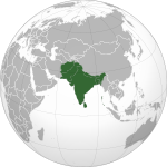
![The 7th and 8th century extent of Kamarupa kingdom, located on the eastern region of the Indian subcontinent, what is today modern-day Assam, Bengal and Bhutan.[1] Kamarupa at its height covered the entire Brahmaputra Valley, parts of North Bengal, Bhutan and northern part of Bangladesh, and at times portions of West Bengal and Bihar.[2]](http://upload.wikimedia.org/wikipedia/commons/thumb/f/ff/Kamarupa_map.png/250px-Kamarupa_map.png) The 7th and 8th century extent of Kamarupa kingdom, located on the eastern region of the Indian subcontinent, what is today modern-day Assam, Bengal and Bhutan.[1] Kamarupa at its height covered the entire Brahmaputra Valley, parts of North Bengal, Bhutan and northern part of Bangladesh, and at times portions of West Bengal and Bihar.[2] | |||||||||||||||
| Capital | Pragjyotishpura Haruppeswara Durjaya | ||||||||||||||
| Common languages | Kamarupi Prakrit, Sanskrit, Austroasiatic, Tibeto-Burman[3] | ||||||||||||||
| Religion | Hinduism, Tribal religion[4] | ||||||||||||||
| Government | Absolute monarchy[5] | ||||||||||||||
| Historical era | Classical India | ||||||||||||||
• Established | 350 | ||||||||||||||
• Disestablished | 1140 | ||||||||||||||
| |||||||||||||||
| Today part of | India Bhutan Bangladesh Nepal | ||||||||||||||
| Part of a series on the |
| History of Assam |
|---|
 |
| Categories |
| History of South Asia |
|---|
 |
| Part of a series on the |
| History of Kamarupa |
|---|
 |
| Ruling dynasties |
Kamarupa (/ˈkɑːməˌruːpə/; also called Pragjyotisha or Pragjyotisha-Kamarupa), an early state[6] during the Classical period on the Indian subcontinent, was (along with Davaka) the first historical kingdom of Assam.[7] The Kamrupa word first appeared in the Samudragupta Allahabad Edict before that there is no mention of existence of this word.[8]
Though Kamarupa prevailed from 350 to 1140 CE, Davaka was absorbed by Kamarupa in the 5th century CE.[9][10] Ruled by three dynasties from their capitals in present-day Guwahati, North Guwahati and Tezpur, Kamarupa at its height covered the entire Brahmaputra Valley, parts of North Bengal,[11] Bhutan and northern part of Bangladesh, and at times portions of what is now West Bengal, Bihar and Sylhet.[2][12]
Though the historical kingdom disappeared by the 12th century to be replaced by smaller political entities, the notion of Kamarupa persisted and ancient and medieval chroniclers continued to call a part of this kingdom Kamrup.[13] In the 16th century the Ahom kingdom came into prominence and assumed for themselves the legacy of the ancient Kamarupa kingdom and aspired to extend their kingdom to the Karatoya River.[14]
- ^ (Dutta 2008:281), reproduced from (Acharya 1968).
- ^ a b Sircar (1990a), pp. 63–68.
- ^ "... (it shows) that in Ancient Assam there were three languages viz. (1) Sanskrit as the official language and the language of the learned few, (2) Non-Aryan tribal languages of the Austric and Tibeto-Burman families, and (3) a local variety of Prakrit (ie a MIA) wherefrom, in course of time, the modern Assamese language as a MIL, emerged." (Sharma 1978, pp. 0.24–0.28)
- ^ (A)ccording to the Yogina Tantra—a product of seventeenth-century Assam—the entire religion of Kamarupa is itself described as kirata dharma, that is, the religion of the northeast hill tribes"(Urban 2011:237)
- ^ "The government of Kamarupa state was absolute monarchy in nature with the king at the top of the political structure." (Boruah 2005:1465)
- ^ "Pragjyotisa-Kamarupa had emerged as an 'early state' by covering a large part of present north-east India, part of neighbouring west-Bengal and Bangladesh in the period between the 4th to the 12th century." (Boruah 2005:1464)
- ^ Suresh Kant Sharma, Usha Sharma - 2005,"Discovery of North-East India: Geography, History, Culture, ... - Volume 3", Page 248, Davaka (Nowgong) and Kamarupa as separate and submissive friendly kingdoms.
- ^ Neog, Dimbeswar. Introduction To Assam. p. 18.
- ^ "As regards the eastern limits of the kingdom, Davaka was absorbed within Kamarupa under Kalyanavarman and the outlying regions were brought under subjugation by Mahendravarman." (Choudhury 1959, p. 47)
- ^ "It is presumed that (Kalyanavarman) conquered Davaka, incorporating it within the kingdom of Kamarupa" (Puri 1968, p. 11)
- ^ "According to the Kalika Purana and the Yogonitantra, the ancient Kamarupa included, besides the districts of modern Assam, Cooch-Behar, Rang-pura, Jalpaiguri and Dinajpur within its territory." (Saikia 1997, p. 3)
- ^ "Before (the 10th century), copper plate inscriptions indicate that land around the Kushiara was more densely populated, because Kamarupa kings had granted large tracts of land to immigrant brahmans and their supporting castes, to make this region part of Assam (Khanda Kamarupa). (Ludden 2003:5081)
- ^ In the medieval times the region between the Sankosh river and the Barnadi river on the northern bank of the Brahmaputra river was defined as Kamrup (or Koch Hajo in Persian chronicles)(Sarkar 1990:95)
- ^ "They also looked upon themselves as the heirs of the glory that was ancient Kamarupa by right of conquest, and they long cherished infructuously their unfulfilled hopes of expanding up to that frontier." (Guha 1983:24). 'An Ahom force reached the banks of the Karatoya in hot pursuit of an invading Turko-Afghan army in the 1530s. Since then "the washing of the sword in the Karatoya" became a symbol of the Assamese aspirations, repeatedly evoked in the Bar-Mels and mentioned in the chronicles." (Guha 1983:33)