Back King's Lynn and West Norfolk District CEB Bwrdeistref King's Lynn a Gorllewin Norfolk Welsh King's Lynn og West Norfolk Danish King’s Lynn and West Norfolk German King's Lynn and West Norfolk Spanish King's Lynn and West Norfolk French King's Lynn and West Norfolk Italian 킹스린 웨스트노퍽 Korean Kingslinna un Rietumnorfolka Latvian/Lettish King's Lynn en West Norfolk Dutch
Borough of King's Lynn and West Norfolk | |
|---|---|
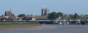
 King's Lynn, known for both King's Lynn Minster and a statue to George Vancouver. The town is the administrative centre and largest settlement in the borough. | |
 Shown within Norfolk | |
| Sovereign state | United Kingdom |
| Constituent country | England |
| Region | East of England |
| Administrative county | Norfolk |
| Admin. HQ | King's Lynn |
| Government | |
| • Type | Borough Council |
| Area | |
| • Total | 560 sq mi (1,440 km2) |
| • Rank | 15th |
| Population (2022) | |
| • Total | 155,741 |
| • Rank | Ranked 136th |
| • Density | 280/sq mi (110/km2) |
| Ethnicity (2021) | |
| • Ethnic groups | |
| Religion (2021) | |
| • Religion | List
|
| Time zone | UTC+0 (Greenwich Mean Time) |
| • Summer (DST) | UTC+1 (British Summer Time) |
| ONS code | 33UE (ONS) E07000146 (GSS) |
Preview warning: Page using Template:Infobox settlement with unknown parameter "1 = leader_name2
"
King's Lynn and West Norfolk is a local government district with borough status in Norfolk, England. Its council is based in the town of King's Lynn. The district also includes the towns of Downham Market and Hunstanton, along with numerous villages and surrounding rural areas. The population of the district at the 2021 census was 154,325.[2]
Part of the borough lies within the Norfolk Coast Area of Outstanding Natural Beauty. The borough lies on the coast, facing both The Wash to the west and the North Sea to the north. The neighbouring districts are North Norfolk, Breckland, West Suffolk, East Cambridgeshire, Fenland and South Holland.
- ^ a b UK Census (2021). "2021 Census Area Profile – King's Lynn and West Norfolk Local Authority (E07000146)". Nomis. Office for National Statistics. Retrieved 5 January 2024.
- ^ "How the population changed in King's Lynn and West Norfolk: Census 2021". ONS. Office for National Statistics. 28 June 2022. Retrieved 28 August 2023.