Back جزيرة كيت Arabic কো কুট জেলা Bengali/Bangla আম্ফোয়ে কো কুত BPY Amphoe Ko Kut CEB Amphoe Ko Kut German Distretto di Ko Kut Italian 꼬꿋 Korean Districtul Ko Kut Romanian อำเภอเกาะกูด Thai Cổ Cốt Vietnamese
Ko Kut
เกาะกูด | |
|---|---|
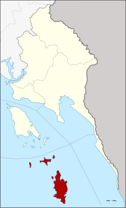
 District location in Trat province | |
| Coordinates: 11°39′30″N 102°32′32″E / 11.65833°N 102.54222°E | |
| Country | Thailand |
| Province | Trat |
| Seat | Ko Kut |
| Area | |
| • Total | 162.2 km2 (62.6 sq mi) |
| Population (2011) | |
| • Total | 2,894 |
| • Density | 17.1/km2 (44/sq mi) |
| Time zone | UTC+7 (ICT) |
| Postal code | 23000 |
| Geocode | 2306 |
Ko Kut (Thai: เกาะกูด, pronounced [kɔ̀ʔ kùːt]) is a district (amphoe) of Trat province, eastern Thailand, consisting of a group of islands. With a population of 2,894 in 2011, it is the district with the smallest population in all of Thailand.