Back كوداجو Arabic كوداجو ARZ कोडगु जिला Bihari কোড়গু জেলা Bengali/Bangla Districte de Kodagu Catalan Kodagu CEB Kodagu (Distrikt) German Kodagu Esperanto Distrito de Kodagu Spanish Kodagu barrutia Basque
Kodagu district
Coorg district, Kodava Naad (Kodava language) | |
|---|---|
Clockwise from top-left: Tadiandamol, Tibetian Golden Temple, Resort view from Tadiandamol , Kumara Parvatha, Harangi Elephant Camp & Tree Park and Abbey Falls, Mandalpatti hill an 18km roadway from Medikeri | |
| Nicknames: Land of Kodava Language, The Land of Warriors, Coffee Cup of India | |
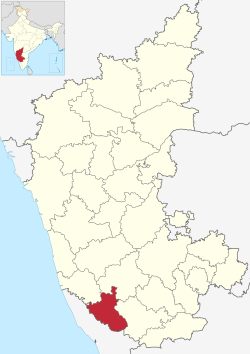
 Location in Karnataka | |
| Coordinates: 12°25′15″N 75°44′23″E / 12.4208°N 75.7397°E | |
| Country | |
| State | |
| Division | Mysuru |
| Region | Malenadu |
| Haleri Dynasty | early 17th century |
| Coorg Province | May 1834 |
| Coorg State | August 15, 1947 |
| Kodagu district | November 1, 1956 |
| Headquarters | Madikeri |
| Talukas | Madikeri, Virajpet, Somwarpet, Ponnampet, Kushalanagar |
| Government | |
| • Deputy Commissioner | Venkat Raja (IAS) |
| • MP | Yaduveer Wadiyar |
| • MLA |
|
| Area | |
| • Total | 4,102 km2 (1,584 sq mi) |
| • Rank | 26th (31 districts) |
| Elevation (Avg. of 5 taluks) | 984 m (3,228 ft) |
| Population (2011)[2] | |
| • Total | 554,519 |
| • Rank | 31st (31 districts) |
| • Density | 140/km2 (350/sq mi) |
| Demonym(s) | Kodava, Kodagaru, Coorgi |
| Languages | |
| • Official | Kannada Kodava [3] |
| Time zone | UTC+5:30 (IST) |
| PIN | 571201 (Madikeri) |
| Telephone code |
|
| Vehicle registration | KA-12 |
| Literacy | 82.52% |
| Lok Sabha | Mysore Lok Sabha constituency |
| Karnataka Legislative Assembly constituency | Madikeri, Virajpet |
| Climate | Tropical Wet (Köppen) |
| Precipitation | 2,725.5 millimetres (107.30 in) |
| Avg. summer temperature | 28.6 °C (83.5 °F) |
| Avg. winter temperature | 14.2 °C (57.6 °F) |
| Website | kodagu |
| Part of a series on the |
| Culture of Karnataka |
|---|
 |
Kodagu district (Kodava: [koɖɐɡɨ]) (also known by its former name Coorg) is an administrative district in the Karnataka state of India. Before 1956, it was an administratively separate Coorg State,[4] at which point it was merged into an enlarged Mysore State.[5]

- ^ "Kodagu district Profile". DSERT. Retrieved 11 January 2011.
- ^ Cite error: The named reference
districtcensuswas invoked but never defined (see the help page). - ^ "Kodagu District Population Census 2011-2021, Karnataka literacy sex ratio and density".
- ^ Chisholm, Hugh, ed. (1911). . Encyclopædia Britannica. Vol. 7 (11th ed.). Cambridge University Press. pp. 91–92.
- ^ Kushalappa, Mookonda (2013). Long ago in Coorg. USA. pp. 356–365. ISBN 9781494282479.
{{cite book}}: CS1 maint: location missing publisher (link)


