Back Бай (езеро) Bulgarian Laguna de Bay Catalan Laguna de Bay CBK-ZAM Laguna de Bay CEB Laguna de Bay Czech Лагуна-де-Бай CV Laguna de Bay German Laguna de Bay Esperanto Laguna de Bay Spanish لاگونا دبی Persian
| Laguna de Bay | |
|---|---|
| Lawa ng Bay (Filipino) | |
 Satellite image of Laguna de Bay in 2020 | |
| Location | |
| Coordinates | 14°23′00″N 121°15′00″E / 14.38333°N 121.25000°E |
| Type | Caldera lake (theorized)/ Tectonic lake |
| Primary inflows | 21 tributaries |
| Primary outflows | Pasig River (via Napindan Channel) |
| Basin countries | Philippines |
| Max. length | 47.3 km (29.4 mi) (E-W) |
| Max. width | 40.5 km (25.2 mi) (N-S) |
| Surface area | 911–949 km² (352–366 sq mi) |
| Average depth | 2.5 m (8 ft 2 in) |
| Max. depth | 20 m (66 ft) (Diablo pass) |
| Shore length1 | 285 km (177 mi) |
| Surface elevation | less 2 m (6 ft 7 in) |
| Islands | Talim Island |
 | |
| 1 Shore length is not a well-defined measure. | |
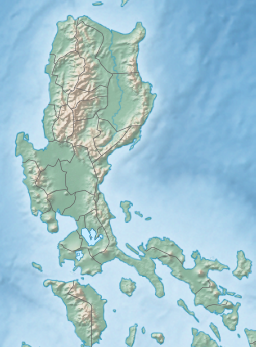
Laguna de Bay (Spanish for "Lagoon/Lake of Bay"; Filipino: Lawa ng Bay, [bɐˈʔi]), also known as Laguna Lake and alternatively spelled "Laguna de Bae",[1] is the largest lake in the Philippines. It is located southeast of Metro Manila, between the provinces of Laguna to the south and Rizal to the north. A freshwater lake, it has a surface area of 911–949 km2 (352–366 sq mi), with an average depth of about 2.8 meters (9 ft 2 in) and an elevation of about one meter above sea level. The lake is shaped like a crow's foot, with two peninsulas jutting out from the northern shore and filling the large volcanic Laguna Caldera. In the middle of the lake is the large island of Talim.
The lake is one of the primary sources of freshwater fish in the country. Its water drains to Manila Bay via the Pasig River. Environmental issues such as water quality problems created by population pressure and industrialization, invasive species and overfishing are of concern for the lake, hurting its economic importance to the country. As population expands in the Bay, its expected to rely more heavily on the lake for freshwater supply, thus water quality directly affects human populations.[2]
- ^ Ilarde, Eddie (August 4, 2018). "The bay, the river, the lake: abandoned and dying". Gulf Times. Retrieved November 29, 2023.
- ^ Tanganco, Lexxel JJ U.; Alberto, Maria Angelica J.; Gotangco, Charlotte Kendra Z. (December 2019). "Forecast of Potential Areas of Urban Expansion in the Laguna de Bay Basin and Its Implications to Water Supply Security" (PDF). Philippine Journal of Science. 148 (4): 715–724. ISSN 0031-7683. Archived from the original (PDF) on August 7, 2022. Retrieved May 16, 2022.

