Back Gardameer Afrikaans Gardasee ALS Laco de Garda AN بحيرة غاردا Arabic بحيره جاردا ARZ Qarda (göl) Azerbaijani Гарда Byelorussian Гарда BE-X-OLD Лаго ди Гарда Bulgarian গারদা হ্রদ Bengali/Bangla
| Lake Garda | |
|---|---|
|
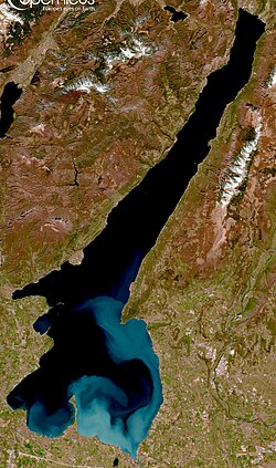
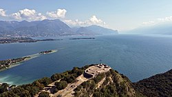
Clockwise from top: Sentinel-2 satellite image of the lake; view of the lake from Manerba; mountains nearby Limone and shared-use path of Garda; panorama of Sirmione; Castel of Malcesine; and panorama of northern-most part of Lake Garda from Nago-Torbole | |
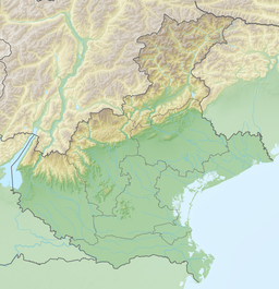
| Coordinates | 45°38′N 10°40′E / 45.633°N 10.667°E |
| Primary inflows | Sarca |
| Primary outflows | Mincio |
| Catchment area | 2,350 km2 (910 sq mi) |
| Basin countries | Italy |
| Max. length | 51.6 km (32.1 mi) |
| Max. width | 16.7 km (10.4 mi) |
| Surface area | 369.98 km2 (142.85 sq mi) |
| Average depth | 136 m (446 ft) |
| Max. depth | 346 m (1,135 ft) |
| Water volume | 50.35 km3 (40,820,000 acre⋅ft) |
| Residence time | 26.8 years |
| Shore length1 | 158.4 km (98.4 mi) |
| Surface elevation | 65 m (213 ft) |
| Islands | 5 (incl. Isola del Garda, Isola San Biagio) |
| Settlements | See article |
| 1 Shore length is not a well-defined measure. | |
Lake Garda (Italian: Lago di Garda, Italian: [ˈlaːɡo di ˈɡarda], or (Lago) Benaco, Italian: [beˈnaːko]; Eastern Lombard: Lach de Garda; Venetian: Ƚago de Garda) is the largest lake in Italy. It is a popular holiday location in northern Italy, between Brescia and Milan to the west, and Verona and Venice to the east. The lake cuts into the edge of the Italian Alps, particularly the Alpine sub-ranges of the Garda Mountains and the Brenta Group. Glaciers formed this alpine region at the end of the last ice age. The lake and its shoreline are divided between the provinces of Brescia (to the south-west), Verona (south-east) and Trentino (north).


