Back Districte de Lamu Catalan Lamu District CEB Lamu County German Condado de Lamu Spanish Lamuko konderria Basque شهرستان لامو Persian Comté de Lamu French County Lamu ID Contea di Lamu Italian ラム (カウンティ) Japanese
Lamu County | |
|---|---|
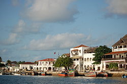
 Lamu, Lamu Island | |
 Location in Kenya | |
| Country | |
| Formed | 4 March 2013 |
| Capital | Lamu |
| Government | |
| • Governor | Issa Timamy |
| Area | |
| • Total | 6,273.1 km2 (2,422.1 sq mi) |
| • Land | 6,273.1 km2 (2,422.1 sq mi) |
| Elevation | 110 m (360 ft) |
| Population (2019) | |
| • Total | 143,920 |
| • Density | 23/km2 (59/sq mi) |
| GDP (PPP) | |
| • GDP | |
| • Per Capita | |
| GDP (NOMINAL) | |
| • GDP | |
| • Per Capita | |
| Time zone | UTC+3 (EAT) |
| Website | www |
Lamu County is a county in Kenya located along the North Coast[2] of the country and is one of the six Coastal Counties[3] in Kenya. Its capital is the town of Lamu. It borders Tana River County to the southwest, Garissa County to the north, Somalia to the northeast, and the Indian Ocean to the South. It is the Smallest County in Kenya by population.
The county has a land surface of 6,273.1 km2 (2,422.1 sq mi), including the mainland[4] and over 65 islands that form the Lamu Archipelago. The total length of the coastline[5] is 130 km (81 mi), while the land water mass[6] area stands at 308 km2 (119 sq mi).[7][8]
- ^ "Kiambu GCP". Retrieved 31 August 2021.
- ^ "Karibu Kenya | North Coast". karibukenya.co.uk. Retrieved 24 October 2022.
- ^ "Coast Region | County Trak Kenya". Retrieved 24 October 2022.
- ^ "Mainland", Wikipedia, 22 November 2022, retrieved 24 January 2023
- ^ "Coast", Wikipedia, 3 January 2023, retrieved 24 January 2023
- ^ "Water mass", Wikipedia, 30 May 2022, retrieved 24 January 2023
- ^ Lamu County Integrated Development Plan CIDP 2018-2022. Lamu County Government. 2018. p. 1.
- ^ "Kenya", Wikipedia, 19 January 2023, retrieved 24 January 2023
