Back ليد Arabic ليد ARZ لید، گونئی داکوتا AZB Lead (Dakota del Sud) Catalan Лид (Къилба Дакота) CE Lead (lungsod) CEB Lead, De Dakota Welsh Lead DAG Lead (Dakota del Sur) Spanish Lead (Hego Dakota) Basque
Lead, South Dakota | |
|---|---|
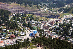
 Aerial photo of Lead in 2004 | |
 Location in Lawrence County and the state of South Dakota | |
| Coordinates: 44°21′10″N 103°46′02″W / 44.35278°N 103.76722°W | |
| Country | United States |
| State | South Dakota |
| County | Lawrence |
| Incorporated | 1890[1] |
| Area | |
| • Total | 2.06 sq mi (5.33 km2) |
| • Land | 2.06 sq mi (5.33 km2) |
| • Water | 0.00 sq mi (0.00 km2) |
| Elevation | 5,296 ft (1,614 m) |
| Population | |
| • Total | 2,982 |
| • Density | 1,448.98/sq mi (559.35/km2) |
| Time zone | UTC−7 (Mountain (MST)) |
| • Summer (DST) | UTC−6 (MDT) |
| ZIP code | 57754 |
| Area code | 605 |
| FIPS code | 46-36220[5] |
| GNIS feature ID | 1267455[3] |
| Website | cityoflead |
Lead Historic District | |
| Architectural style | Greek Revival, Hip cottage |
| NRHP reference No. | 74001892[6] |
| Added to NRHP | December 31, 1974 |

Lead (/ˈliːd/ LEED)[7] is a city in Lawrence County, South Dakota, United States. The population was 2,982 at the 2020 census.[8] Lead is located in western South Dakota, in the Black Hills near the Wyoming state line.
- ^ "SD Towns" (PDF). South Dakota State Historical Society. Archived from the original (PDF) on February 10, 2010. Retrieved February 14, 2010.
- ^ "ArcGIS REST Services Directory". United States Census Bureau. Retrieved October 15, 2022.
- ^ a b U.S. Geological Survey Geographic Names Information System: Lead, South Dakota
- ^ Cite error: The named reference
USCensusDecennial2020CenPopScriptOnlywas invoked but never defined (see the help page). - ^ "U.S. Census website". United States Census Bureau. Archived from the original on December 27, 1996. Retrieved January 31, 2008.
- ^ "National Register Information System". National Register of Historic Places. National Park Service. March 13, 2009.
- ^ "Broadcast Pronunciation Guide and South Dakota Pronunciations". Associated Press. Archived from the original on June 14, 2011. Retrieved November 10, 2009.
- ^ "U.S. Census Bureau: Lead city, South Dakota". www.census.gov. United States Census Bureau. Archived from the original on August 7, 2022. Retrieved May 5, 2022.