Back Limousin Afrikaans Lemosín AN ليموزان Arabic Llemosín (rexón) AST Limousin suyu Aymara Limuzin (region) Azerbaijani لیموزن AZB Лімузен Byelorussian Лімузэн BE-X-OLD Лимузен Bulgarian
You can help expand this article with text translated from the corresponding article in French. (January 2010) Click [show] for important translation instructions.
|
Limousin
Lemosin (Occitan) | |
|---|---|
 | |
| Coordinates: 45°41′17″N 1°37′14″E / 45.68795°N 1.620483°E | |
| Country | |
| Dissolved | 2016-01-01 |
| Prefecture | Limoges |
| Departments | 3
|
| Government | |
| • President | Gérard Vandenbroucke (PS) |
| Area INSEE | |
| • Total | 16,942 km2 (6,541 sq mi) |
| Population (2010-01-01)[1] | |
| • Total | 742,770 |
| • Density | 44/km2 (110/sq mi) |
| GDP | |
| • Total | €20.735 billion (2022) |
| • Per capita | €28,300 (2022) |
| Time zone | UTC+01:00 (CET) |
| • Summer (DST) | UTC+02:00 (CEST) |
| ISO 3166 code | FR-L |
| NUTS Region | FR6 |
| Website | (in French)cr-limousin.fr |
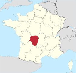
Limousin (French pronunciation: [limuzɛ̃] ; Occitan: Lemosin [lemuˈzi]) is a former administrative region of southwest-central France. On 1 January 2016, it became part of the new administrative region of Nouvelle-Aquitaine.[3] It comprised three departments: Corrèze, Creuse, and Haute-Vienne.
Situated mostly in the west side of south-central French Massif Central, Limousin had (in 2010) 742,770 inhabitants[1] spread out on nearly 17,000 km2 (6,600 square miles), making it the least populated region of metropolitan France.
Forming part of the southwest of the country, Limousin was bordered by the regions of Centre-Val de Loire to the north, Auvergne to the east, Midi-Pyrénées to the south, Aquitaine to the southwest, and Poitou-Charentes to the west. Limousin was also part of the larger historical Occitania region.
- ^ a b INSEE, 2010 census results
- ^ "EU regions by GDP, Eurostat". Retrieved 18 September 2023.
- ^ Loi n° 2015-29 du 16 janvier 2015 relative à la délimitation des régions, aux élections régionales et départementales et modifiant le calendrier électoral (in French)

