Back Lucera Afrikaans Lucera ALS لوجارة Arabic Lucera AST لوچرا AZB Лучера Bulgarian Lucera Breton Lucera Catalan Лучера CE Lucera (munisipyo) CEB
You can help expand this article with text translated from the corresponding article in Italian. (March 2021) Click [show] for important translation instructions.
|
Lucera | |
|---|---|
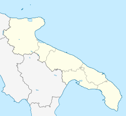
 Location of Lucera in the province of Foggia | |
| Coordinates: 41°30′N 15°20′E / 41.500°N 15.333°E | |
| Country | Italy |
| Region | |
| Province | Foggia (FG) |
| Government | |
| • Mayor | Giuseppe Pitta (coalition of municipal lists) |
| Area | |
| • Total | 339.79 km2 (131.19 sq mi) |
| Elevation | 219 m (719 ft) |
| Population (June 2012)[3] | |
| • Total | 34,243 |
| Demonym | Lucerini |
| Time zone | UTC+1 (CET) |
| • Summer (DST) | UTC+2 (CEST) |
| Postal code | 71036 |
| Dialing code | 0881 |
| Patron saint | St Mary |
| Saint day | 16 August |
| Website | Official website |
Lucera (Lucerino: Lucére) is an Italian city of 34,243 inhabitants in the province of Foggia in the region of Apulia, and the seat of the Diocese of Lucera-Troia.
Located upon a flat knoll in the Tavoliere Plains, near the foot of Daunian Mountains, Lucera was the capital of Province of Capitanata and the County of Molise from 1579 until 1806.


