Back Dálnice M45 Czech M45 motorway German آزادراه ام۴۵ Persian Autostrada M45 (Gran Bretagna) LMO M45 (Groot-Brittannië) Dutch M45 (motorvei) NB M45 motorway SIMPLE M45 Swedish
| M45 | ||||
|---|---|---|---|---|
M45 highlighted in blue | ||||
| Route information | ||||
| Maintained by National Highways | ||||
| Length | 7.9 mi (12.7 km) | |||
| Existed | 1959–present | |||
| Major junctions | ||||
| East end | Watford Gap | |||
| West end | Thurlaston | |||
| Location | ||||
| Country | United Kingdom | |||
| Primary destinations | Rugby, Coventry | |||
| Road network | ||||
| ||||


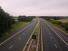
The M45 is a motorway in Northamptonshire and Warwickshire, England and is 7.9 miles (12.7 km) long. It runs between junction 17 of the M1 motorway south east of Rugby and a junction with the A45 road southwest of Rugby. It has one of the lowest traffic volumes of the United Kingdom motorway system.[citation needed]

