Back ماربل هيل (ميزوري) Arabic ماربل هیل، میزوری AZB Marble Hill (Missouri) Catalan Марбл-Гилл (Миссури) CE Marble Hill (kapital sa kondado) CEB Marble Hill, Missouri Welsh Marble Hill (Misuri) Spanish Marble Hill (Missouri) Basque ماربل هیل، میزوری Persian Marble Hill (Missouri) French
Marble Hill, Missouri | |
|---|---|
 Marble Hill City Hall, April 2014. | |
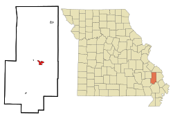
 Location of Marble Hill, Missouri | |
| Coordinates: 37°18′18″N 89°58′51″W / 37.30500°N 89.98083°W | |
| Country | United States |
| State | Missouri |
| County | Bollinger |
| Government | |
| • Type | Mayor-Council |
| • Mayor | Trey Wiginton |
| Area | |
| • Total | 1.66 sq mi (4.30 km2) |
| • Land | 1.65 sq mi (4.28 km2) |
| • Water | 0.01 sq mi (0.01 km2) |
| Elevation | 400 ft (100 m) |
| Population (2020) | |
| • Total | 1,388 |
| • Density | 839.18/sq mi (323.93/km2) |
| Time zone | UTC-6 (Central (CST)) |
| • Summer (DST) | UTC-5 (CDT) |
| ZIP code | 63764 |
| Area code | 573 |
| FIPS code | 29-45848[3] |
| GNIS feature ID = | 2395000[2] |
Marble Hill is a fourth-class city in central Bollinger County in Southeast Missouri, United States. Located at the intersection of State Highways 34 and 51, it is the largest city in Bollinger and serves as the county seat.[4] The population was 1,388 at the 2020 census.[5] The city was officially organized in July 1851 and is named after a marble-like rock.
Marble Hill is part of the Cape Girardeau−Jackson, MO-IL Metropolitan Statistical Area.
- ^ "ArcGIS REST Services Directory". United States Census Bureau. Retrieved August 28, 2022.
- ^ a b U.S. Geological Survey Geographic Names Information System: Marble Hill, Missouri
- ^ "U.S. Census website". United States Census Bureau. Retrieved January 31, 2008.
- ^ "Find a County". National Association of Counties. Retrieved June 7, 2011.
- ^ "Explore Census Data". data.census.gov. Retrieved January 9, 2022.