Back Markland Catalan Markland Czech Markland Danish Markland German Markland Spanish Markland Estonian Markland Basque Markland French Markland Italian マルクランド Japanese
| Part of a series on the |
| Norse colonization of North America |
|---|
 |

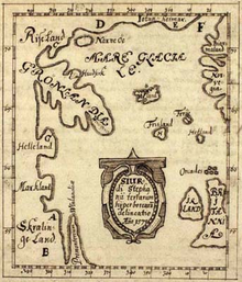
• Land of the Risi (a mythical location)
• Greenland
• Helluland (Baffin Island)
• Markland (the Labrador Peninsula)
• Land of the Skræling (location undetermined)
• Promontory of Vinland (the Great Northern Peninsula)
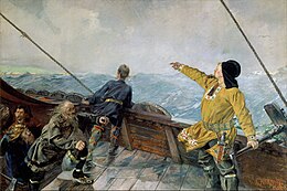
Markland (Old Norse pronunciation: [ˈmɑrkˌlɑnd]) is the name given to one of three lands on North America's Atlantic shore discovered by Leif Eriksson around 1000 AD. It was located south of Helluland and north of Vinland.
Although it was never recorded to be settled by Norsemen, there were probably a number of later expeditions from Greenland to gather timber.[2] A 1347 Icelandic document records that a ship went off course and ended up in Iceland in the process of returning from Markland, without further specifying where Markland was.[3]
- ^ http://www.myoldmaps.com/renaissance-maps-1490-1800/4316-skalholt-map/4316-skalholt-map.pdf [bare URL PDF]
- ^ "The Vinland sagas". National Museum of Natural History. Arctic Studies Center.
- ^ Seaver, Kristen A. (1996). The Frozen Echo: Greenland and the Exploration of North America, Ca. A.D. 1000–1500. Stanford University Press. p. 28. ISBN 0-8047-3161-6.