Merthyr Dyfan | |
|---|---|
District of Barry and parish/ward | |
 The parish church of St Dyfan and St Teilo | |
| Coordinates: 51°25′14″N 3°16′15″W / 51.42056°N 3.27083°W | |
| Country | United Kingdom |
| Region | Wales |
| County | Vale of Glamorgan |
| Town | Barry |
| Population (2011) | |
| • Total | 5,166 |
| (ward)[1] | |
| Time zone | UTC+0 (GMT) |
| Area code | CF |
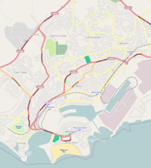
Merthyr Dyfan or Dyfan is a northeastern suburb of Barry in the Vale of Glamorgan, in south Wales, formerly an independent medieval village. It is also an ecclesiastical parish[2] and a formal[clarification needed] electoral ward of the Vale of Glamorgan. It borders Colcot to the west, Buttrills to the southwest and Gibbonsdown to the southeast. Its main roads are Merthyr Dyfan Road, a hilly road leading down from the A4050 road (Port Road) which leads into Wenvoe and Cardiff; and Skomer Road which separates it from Gibbonsdown and eventually also leads to the A4050 road. Merthyr Dyfan contains an old parish church, Barry Rugby Club, Bryn Hafren Comprehensive School and the Master Mariner Pub and Holm View Leisure Centre, although the last two could be considered to be in northern Gibbonsdown.
- ^ "Ward population 2011". Retrieved 9 April 2015.
- ^ Merthyr Dyfan L084 Archived 19 August 2016 at the Wayback Machine, The Church in Wales. Retrieved 10 April 2016.

