Back مطار باماكو موديبو كيتا الدولي Arabic Aeropuertu Internacional de Bamaku-Sénou AST Bamako–Sénou International Airport CEB Flughafen Bamako German Aeropuerto Internacional de Bamako-Sénou Spanish فرودگاه بینالمللی باماکو-سانوو Persian Senoun kansainvälinen lentoasema Finnish Aéroport international Modibo-Keïta French Filin jirgin saman Bamako Hausa נמל התעופה הבין-לאומי מודיבו קייטה HE
Modibo Keita International Airport Aéroport international Modibo Keita | |||||||||||
|---|---|---|---|---|---|---|---|---|---|---|---|
 | |||||||||||
| Summary | |||||||||||
| Airport type | Joint (Public/Military) | ||||||||||
| Operator | Aéroports du Mali (ADM) | ||||||||||
| Location | Bamako, Mali | ||||||||||
| Opened | 1974 | ||||||||||
| Elevation AMSL | 1,247 ft / 380 m | ||||||||||
| Coordinates | 12°32′16″N 07°56′35″W / 12.53778°N 7.94306°W | ||||||||||
| Website | www | ||||||||||
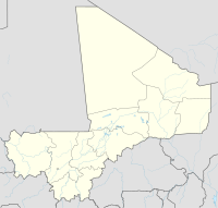
| Map | |||||||||||
 | |||||||||||
| Runways | |||||||||||
| |||||||||||
*planned runway length extension to 10,444 ft. / 3,180 m complete by 9 Mar 2010 as part of Mali MCC.[1] | |||||||||||
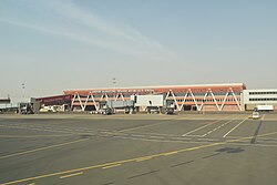
Modibo Keita International Airport (IATA: BKO, ICAO: GABS) (formerly Bamako–Sénou International Airport) is Mali's main airport located approximately 15 kilometres (9.3 mi) south of downtown Bamako, the capital of Mali in West Africa. It is the country's only international airport. It is managed by Aéroports du Mali (ADM).[1] Its operations are overseen by the Malian Ministry of Equipment and Transport.[2]
- ^ a b Composante aéroport Bamako–Sénou Archived 27 July 2011 at the Wayback Machine, Proposition MCA-Mali (2006)
- ^ Cite error: The named reference
pana0109was invoked but never defined (see the help page).
