Back مولده Arabic Muoldė BAT-SMG Моле Byelorussian Мольдэ BE-X-OLD Молде Bulgarian Molde BJN মোলডে BPY Molde Catalan Molde (munisipyo) CEB Molde Czech
Molde Municipality
Molde kommune | |
|---|---|
 Eastward view of Molde. Molde Cathedral (left). | |
|
| |
 Møre og Romsdal within Norway | |
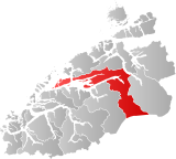
 Molde within Møre og Romsdal | |
| Coordinates: 62°45′23″N 07°14′19″E / 62.75639°N 7.23861°E | |
| Country | Norway |
| County | Møre og Romsdal |
| District | Romsdal |
| Established | 1 Jan 1838 |
| • Created as | Formannskapsdistrikt |
| Administrative centre | Molde |
| Government | |
| • Mayor (2023) | Trygve Grydeland (H) |
| Area | |
• Total | 1,503.37 km2 (580.45 sq mi) |
| • Land | 1,434.94 km2 (554.03 sq mi) |
| • Water | 68.42 km2 (26.42 sq mi) 4.6% |
| • Rank | #56 in Norway |
| Population (2023) | |
• Total | 32,446 |
| • Rank | #31 in Norway |
| • Density | 22.6/km2 (59/sq mi) |
| • Change (10 years) | |
| Demonyms | Moldenser Moldensar[1] |
| Official language | |
| • Norwegian form | Neutral |
| Time zone | UTC+01:00 (CET) |
| • Summer (DST) | UTC+02:00 (CEST) |
| ISO 3166 code | NO-1506[3] |
| Website | Official website |
Molde (Norwegian pronunciation: [ˈmɔ̂ɫdə] ) is a town and municipality in Møre og Romsdal county, Norway. It is located in the traditional district of Romsdal. It is located on the Romsdal Peninsula, surrounding the Fannefjord and Moldefjord.
The administrative centre of the municipality is the city of Molde which is also the administrative centre of Møre og Romsdal county, the commercial hub of the Romsdal region, and the seat of the Diocese of Møre. Other main population centres in the municipality include the villages of Hjelset, Kleive, Nesjestranda, Midsund, Nord-Heggdal, Eidsvåg, Rausand, Boggestranda, Myklebostad, Eresfjord, and Eikesdalen.
Molde has a maritime, temperate climate, with cool-to-warm summers, and relatively mild winters. The city is nicknamed The City of Roses.[4]
Molde was originally the name of a farm by a natural harbour, which grew into a timber trading port in the late 16th century.[5] Formal trading rights were introduced before 1604,[6] and the town was incorporated through a royal charter in 1742. Molde was established as a municipality on 1 January 1838 (see formannskapsdistrikt law).
The town continued to grow throughout the 18th and 19th centuries, becoming a centre for Norwegian textile and garment industry, as well as the administrative centre for the region, and a major tourist destination. After World War II, Molde experienced accelerated growth, merging with Bolsøy Municipality and parts of Veøy Municipality on 1 January 1964, and has become a centre for not only administrative and public services, but also academic resources and industrial output.
The 1,503-square-kilometre (580 sq mi) municipality is the 56th largest by area out of the 356 municipalities in Norway. Molde is the 31st most populous municipality in Norway with a population of 32,446. The municipality's population density is 22.6 inhabitants per square kilometre (59/sq mi) and its population has increased by 4.9% over the previous 10-year period.[7][8]
- ^ "Navn på steder og personer: Innbyggjarnamn" (in Norwegian). Språkrådet.
- ^ "Forskrift om målvedtak i kommunar og fylkeskommunar" (in Norwegian). Lovdata.no.
- ^ Bolstad, Erik; Thorsnæs, Geir, eds. (26 January 2023). "Kommunenummer". Store norske leksikon (in Norwegian). Kunnskapsforlaget.
- ^ "The rose gardens in Molde - The city of roses". Visit Norway. Archived from the original on 22 October 2020. Retrieved 19 October 2020.
- ^ Grüner, Otto R. (1972). Hollendertida i Romsdal: sagbruk og trelasthandel på 1600-tallet (in Norwegian). Rune forlag.
- ^ Kvernberg, Anders (2022). "'Ladeplatzen udi Molde Fiære' – et kritisk blikk på noen av Bolsøybokas mytedannelser". Årsskrift. Romsdal sogelag: 83 – via nb.no (access required).
- ^ Statistisk sentralbyrå. "Table: 06913: Population 1 January and population changes during the calendar year (M)" (in Norwegian).
- ^ Statistisk sentralbyrå. "09280: Area of land and fresh water (km²) (M)" (in Norwegian).

