Back मानसून ट्रफ Bihari Creux de mousson French Palung muson ID Monsuntråg NN Cavado de monção Portuguese මෝසම් දෙකිඳ Singhalese Monsoon trough SIMPLE 季风槽 Chinese

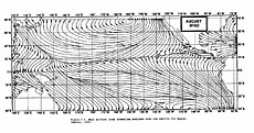
The monsoon trough is a portion of the Intertropical Convergence Zone in the Western Pacific,[1][2] as depicted by a line on a weather map showing the locations of minimum sea level pressure,[1] and as such, is a convergence zone between the wind patterns of the southern and northern hemispheres.
Westerly monsoon winds lie in its equatorward portion while easterly trade winds exist poleward of the trough.[3] Right along its axis, heavy rains can be found which usher in the peak of a location's respective rainy season. The monsoon trough plays a role in creating many of the world's rainforests.[4]
The term monsoon trough is most commonly used in monsoonal regions of the Western Pacific such as Asia and Australia. The migration of the ITCZ/monsoon trough into a landmass heralds the beginning of the annual rainy season during summer months. Depressions and tropical cyclones often form in the vicinity of the monsoon trough, with each capable of producing a year's worth of rainfall in a matter of days.
- ^ a b "Monsoon trough". Glossary of Meteorology. American Meteorological Society. Archived from the original on 17 June 2009. Retrieved 4 June 2009.
- ^ Bin Wang. The Asian Monsoon. Retrieved 2008-05-03.
- ^ World Meteorological Organization. Severe Weather Information Centre. Retrieved 2008-05-03.
- ^ Hobgood (2008)Global Pattern of Surface Pressure and Wind. Archived 18 March 2009 at the Wayback Machine Ohio State University. Retrieved 2009-03-08.