Back مور (أوكلاهوما) Arabic مور (كليفلاند, اوكلاهوما) ARZ مور، اوکلاهوما AZB Moore (Oklahoma) Catalan Мур (Оклахома) CE Moore (lungsod sa Tinipong Bansa, Oklahoma) CEB Moore DAG Moore (Oklahoma) German Moore (Oklahoma) Spanish Moore (Oklahoma) Basque
Moore, Oklahoma | |
|---|---|
 (2024) | |
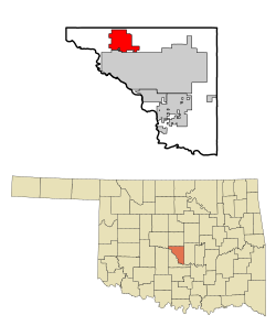
 Location within Cleveland County and Oklahoma | |
| Coordinates: 35°19′45″N 97°28′32″W / 35.32917°N 97.47556°W | |
| Country | United States |
| State | Oklahoma |
| County | Cleveland |
| Founded | 1889 |
| Incorporated | 1893 |
| Government | |
| • Mayor | Mark Hamm |
| • City Manager | Brooks Mitchell |
| Area | |
• Total | 22.34 sq mi (57.86 km2) |
| • Land | 22.09 sq mi (57.21 km2) |
| • Water | 0.25 sq mi (0.64 km2) |
| Elevation | 1,207 ft (368 m) |
| Population (2020) | |
• Total | 62,793 |
| • Density | 2,842.47/sq mi (1,097.49/km2) |
| Time zone | UTC−6 (Central (CST)) |
| • Summer (DST) | UTC−5 (CDT) |
| ZIP codes | 73160, 73165, 73170 [3] |
| Area code(s) | 405/572 |
| FIPS code | 40-49200 |
| GNIS feature ID | 2411155[2] |
| Website | cityofmoore.com |
Moore is a city in Cleveland County, Oklahoma, United States,[2] and is part of the Oklahoma City metropolitan area. The population was 62,793 at the 2020 census,[4] making Moore the seventh-largest city in the state of Oklahoma.
Located between Oklahoma City and Norman, the city has been the site of several devastating tornadoes, with those occurring in 1999 and 2013 receiving international attention. The 3 costliest tornadoes in Oklahoma history all occurred in Moore.[5]
- ^ "ArcGIS REST Services Directory". United States Census Bureau. Retrieved September 20, 2022.
- ^ a b c U.S. Geological Survey Geographic Names Information System: Moore, Oklahoma
- ^ United States Postal Service (2012). "USPS - Look Up a ZIP Code". Retrieved February 15, 2012.
- ^ "QuickFacts: Moore city, Oklahoma". U.S. Census Bureau, QuickFacts. Retrieved March 14, 2022.
- ^ Top Ten Costliest Oklahoma Tornadoes (1950-Present), National Weather Service Norman, Oklahoma
