Back جبل مونت باناهاو ARZ Mount Banahao CEB Banahaw Czech Banahaw German Banahaw Spanish کوه باناهو Persian Mont Banahaw French Bantay Banahaw ILO Monte Banahaw Italian ბანაჰაო Georgian
| Mount Banahaw | |
|---|---|
| Banahao | |
 Mount Banahaw, seen from Victoria, Laguna | |
| Highest point | |
| Elevation | 2,170 m (7,120 ft)[1][2] |
| Prominence | 1,919 m (6,296 ft)[1] |
| Listing | |
| Coordinates | 14°04′03″N 121°29′33″E / 14.06750°N 121.49250°E[1][3] |
| Geography | |
 | |
| Country | Philippines |
| Region | Calabarzon |
| Province | |
| Cities and municipalities | |
| Topo map(s) | Mount Banahaw Relief Map, SRTM-1.jpg |
| Geology | |
| Mountain type | Stratovolcano complex |
| Volcanic arc/belt | Macolod Corridor |
| Last eruption | 1909 |
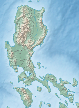
Mount Banahaw (IPA: [bɐˈnahaʊ]; also spelled as Banahao and Banájao) is an active complex volcano on Luzon in the Philippines. The three-peaked volcano is located at the boundary of Laguna and Quezon provinces. It is the highest mountain in both provinces and Calabarzon region, dominating the landscape for miles around.[4]
The mountain is considered by many a holy mountain, thus a bundok dambana, and is popular among pilgrims along with mountain climbers. It is located in a protected area known as Mounts Banahaw–San Cristobal Protected Landscape covering 10,901 hectares (26,940 acres) of land.[5][6]
- ^ a b c "Philippines Mountains" – Ultra Prominence Page. Peaklist.org. Listed here as "Mount Banahao". Retrieved April 5, 2012.
- ^ "Mount Banahao, Philippines". Peakbagger.com. Retrieved April 5, 2012.
- ^ "Banahaw". Global Volcanism Program. Smithsonian Institution. Retrieved December 19, 2010.
- ^ Cite error: The named reference
PMwas invoked but never defined (see the help page). - ^ "Protected Areas in Region IV-A (CALABARZON)" Archived September 29, 2011, at the Wayback Machine. Protected Areas and Wildlife Bureau. Retrieved on September 26, 2011.
- ^ "NIPAS Initial Components (PDF)" Archived March 20, 2012, at the Wayback Machine. Protected Areas and Wildlife Bureau. Retrieved on September 26, 2011.

