| Leyton | |
|---|---|
 Leyton Town Hall | |
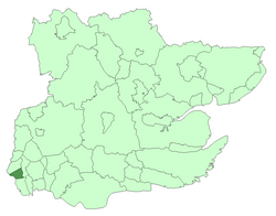
 Leyton within Essex in 1961 | |
| Area | |
| • 1901 | 2,594 acres (10.5 km2) |
| • 1931 | 2,594 acres (10.5 km2) |
| • 1961 | 2,595 acres (10.5 km2) |
| Population | |
| • 1901 | 98,912 |
| • 1931 | 128,313 |
| • 1961 | 93,959 |
| Density | |
| • 1901 | 38.1/acre |
| • 1931 | 49.5/acre |
| • 1961 | 36.2/acre |
| History | |
| • Origin | Leyton St Mary ancient parish |
| • Created | 1873 |
| • Abolished | 1965 |
| • Succeeded by | London Borough of Waltham Forest |
| Status | Local government district (1873–1894) Urban district (1894–1926) Municipal borough (1926–1965) |
| Government | Leyton Local Board (1873–1894) Leyton Urban District Council (1894–1926) Leyton Borough Council (1926–1965) |
| • HQ | High Road, Leyton |
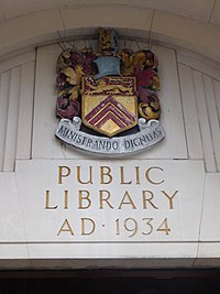
| • Motto | MINISTRANDO DIGNITAS (Dignity in service) |
 Leyton's coat of arms outside Leytonstone Library | |
| Subdivisions | |
| • Type | Civil parishes |
| • Units | Leyton (1873–1965)[note a] Wanstead (part) (1883–1894) Cann Hall (1894–1965) |
Leyton was a local government district in southwest Essex, England, from 1873 to 1965. It included the neighbourhoods of Leyton, Leytonstone and Cann Hall. It was suburban to London, forming part of the London postal district and Metropolitan Police District. It now forms the southernmost part of the London Borough of Waltham Forest in Greater London.
