Back منطقة ميسور Arabic ميسور ARZ मैसूर जिला Bihari মহীশূর জেলা Bengali/Bangla Districte de Mysore Catalan Mysore (distrito) CEB Mysuru (Distrikt) German Distrito de Mysore Spanish Mysore barrutia Basque بخش میسورا Persian
Mysore District | |
|---|---|
Clockwise from top-left; Mysore Palace, Chennakeshava Temple, Somanathapura, Mall in Jayalakshmipuram, Nagarhole Tiger Reserve and Mahishasura Statue near Chamundeshwari Temple | |
| Nickname: Kaveri Nadu | |
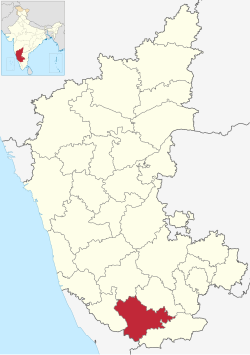
 Location in Karnataka | |
| Coordinates: 12°13′N 76°29′E / 12.21°N 76.49°E | |
| Country | |
| State | Karnataka |
| Division | Mysore division |
| Headquarters | Mysore |
| Taluks | Mysore Rural, Tirumakudalu Narasipura, Nanjangud, Heggadadevanakote, Hunsur, Piriyapatna, Krishnarajanagara, Sargur, Saligrama[1] |
| Government | |
| • Deputy Commissioner | Rajendra K V |
| ISO 3166 code | IN-KA |
| Vehicle registration | KA-09, KA-45, KA-55 |
| Website | mysore |
Mysore district, officially Mysuru district, is an administrative district located in the southern part of the state of Karnataka, India. It is the administrative headquarters of Mysore division.[2] Chamarajanagar District was carved out of the original larger Mysore District in the year 1998. The district is bounded by Chamrajanagar district to the southeast, Mandya district to the east and northeast, Kerala state to the south, Kodagu district to the west, and Hassan district to the north.[3]
This district has a prominent place in the history of Karnataka; Mysore was ruled by the Wodeyars from the year 1399 till the independence of India in the year 1947. It features many tourist destinations, from Mysore Palace to Nagarhole National Park. It is the third-most populous district in Karnataka (out of 31), after Bangalore Urban and Belgaum.[4]
- ^ "District census Hand book" (PDF). Census Registrar, Government of India. Retrieved 7 March 2020.
- ^ "KARNATAKA LEGISLATURE". www.kla.kar.nic.in. Retrieved 9 December 2020.
- ^ Census of India 2011, District Census Handbook, Mysore (PDF). Government of India. 2011.
- ^ Cite error: The named reference
districtcensuswas invoked but never defined (see the help page).


