Back Namur (stad) Afrikaans ናሙር Amharic نامور Arabic نامور ARZ Namur AST Namür Azerbaijani نمور، بلژیک AZB Намюр Byelorussian Намюр BE-X-OLD Намюр Bulgarian
This article needs additional citations for verification. (May 2015) |
Namur
Nameur (Walloon) Namen (Dutch) | |
|---|---|
| Coordinates: 50°28′N 04°52′E / 50.467°N 4.867°E | |
| Country | |
| Community | French Community |
| Region | Wallonia |
| Province | Namur |
| Arrondissement | Namur |
| Government | |
| • Mayor | Maxime Prévot (Les Engagés) |
| • Governing party/ies | Les Engagés-Ecolo-MR |
| Area | |
| • Total | 175.93 km2 (67.93 sq mi) |
| Population (2024-01-01)[1] | |
| • Total | 114,007 |
| • Density | 650/km2 (1,700/sq mi) |
| Postal codes | 5000, 5001, 5002, 5003, 5004, 5020, 5021, 5022, 5024, 5100, 5101 |
| NIS code | 92094 |
| Area codes | 081 |
| Website | www.namur.be |
 Brandmark of Namur | |
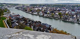
Namur (French: [namyʁ] ;[a] Walloon: Nameur; Dutch: Namen [ˈnaːmə(n)] ) is a city and municipality in Wallonia, Belgium. It is the capital both of the province of Namur and of Wallonia, hosting the Parliament of Wallonia, the Government of Wallonia and its administration.
Namur stands at the confluence of the rivers Sambre and Meuse and straddles three different regions – Hesbaye to the north, Condroz to the south-east, and Entre-Sambre-et-Meuse to the south-west. The city of Charleroi is located to the west. The language spoken is French.
The municipality consists of the following sub-municipalities: Beez, Belgrade, Boninne, Bouge, Champion, Cognelée, Daussoulx, Dave, Erpent, Flawinne, Gelbressée, Jambes, Lives-sur-Meuse, Loyers, Malonne, Marche-les-Dames, Namur proper, Naninne, Saint-Servais, Saint-Marc, Suarlée, Temploux, Vedrin, Wépion, and Wierde.
Cite error: There are <ref group=lower-alpha> tags or {{efn}} templates on this page, but the references will not show without a {{reflist|group=lower-alpha}} template or {{notelist}} template (see the help page).


