Back Rhwydwaith Beicio Cenedlaethol Welsh National Cycle Network French רשת האופניים הלאומית HE National Cycle Network Icelandic National Cycle Network Italian National Cycle Network Dutch 国家自行车网络 Chinese


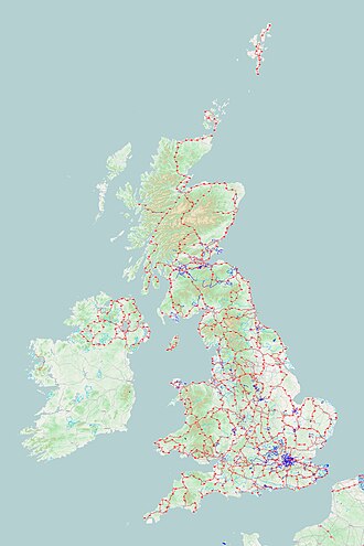
The National Cycle Network (NCN) was established to encourage cycling and walking throughout the United Kingdom, as well as for the purposes of bicycle touring. It was created by the charity Sustrans who were aided by a £42.5 million National Lottery grant. However Sustrans themselves only own around 2% of the paths on the network, the rest being made of existing public highways and rights of way, and permissive paths negotiated by Sustrans with private landowners.
In 2017, the Network was used for over 786 million cycling and walking trips, made by 4.4 million people.
In 2020, around a quarter of the NCN was scrapped on safety grounds,[1] leaving 12,739 miles (20,501 km) of signed routes. These are made up of 5,220 miles (8,400 km) of traffic-free paths with the remaining 7,519 miles (12,101 km) on-road.[2] It uses shared use paths, disused railways, minor roads, canal towpaths and traffic-calmed routes in towns and cities.
- ^ a b "National Cycle Network cuts a quarter of its routes on safety grounds". The Guardian. 19 July 2020. Retrieved 2 December 2022.
- ^ "National Cycle Network report". Sustrans. Sustrans. 2018. Retrieved 15 November 2018.