Back Nikosia ACE Nicosia Afrikaans Nikosia ALS ሌፍኮዚያ Amharic Nicosia AN نيقوسيا Arabic نيكوسيا ARZ Nicosia AST Никосия AV Nikosiya Azerbaijani
Nicosia
| |
|---|---|
Left to right: Nicosia skyline from Shacolas Tower; Ledra Street from Socratous Street; Eleftheria Square; door in the Old Town; Venetian Homes; Nicosia Christmas fair at Eleftheria Square; Makariou Avenue | |
| Nickname: "Chora" in Greek: "Χώρα"[1] | |
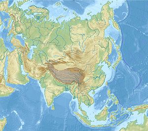
Location within Cyprus Location within the Eastern Mediterranean Location within the European Union Location within Asia | |
| Coordinates: 35°10′21″N 33°21′54″E / 35.17250°N 33.36500°E | |
| Claimed by | |
| Country (de jure) | |
| • District | Nicosia District |
| Country (northern part, de facto) | |
| • District | Lefkoşa District |
| Government | |
| • Mayor of Nicosia Municipality | Charalambos Prountzos (Ind.) |
| • Mayor of Nicosia Turkish Municipality | Mehmet Harmancı |
| Area | |
| • Municipality | 20.08 km2 (7.75 sq mi) |
| • Urban | 153.11 km2 (59.12 sq mi) |
| • Municipality (North) | 51.87 km2 (20.03 sq mi) |
| • Urban (North) | 165.6 km2 (63.9 sq mi) |
| Elevation | 220 m (720 ft) |
| Population | |
| • Municipality | 56,848 |
| • Rank | 3rd municipality,[7] 1st urban in Cyprus |
| • Urban | 256,119 |
| • Urban density | 1,700/km2 (4,300/sq mi) |
| • Municipality (North) | 61,378 |
| • Urban (North) | 82,929 |
| • Urban (North) density | 500/km2 (1,300/sq mi) |
| [a] | |
| Demonym(s) | Nicosian(s) (en) Lefkosiatis, (masc.), Lefkosiatissa (fem.) (gr), Choraitis, (masc.), Choraitissa (fem.) (gr, colloquial) |
| Time zone | UTC+2 (EET) |
| • Summer (DST) | UTC+3 (EEST) |
| Post code | 1010–1107 |
| Area code | 22 |
| ISO 3166 code | CY-01 |
| Website |
|
Nicosia,[b] also known as Lefkosia[c] and Lefkoşa,[d] is the capital and largest city of Cyprus. It is the southeasternmost of all EU member states' capital cities.
Nicosia has been continuously inhabited for over 4,500 years and has been the capital of Cyprus since the 10th century. It is the last divided capital in Europe; three years after Cyprus gained independence from British rule in 1960, the Bloody Christmas conflict between Greek Cypriots and Turkish Cypriots triggered island-wide intercommunal violence, and Nicosia's Greek Cypriot and Turkish Cypriot communities segregated into its south and north respectively in 1964. A decade later, Turkey invaded Cyprus following Greece's successful attempt to take over the island. The leaders of the takeover would later step down, but the dividing line running through Nicosia (and the rest of the island, interrupted only briefly by British military bases) became a demilitarised zone that remains under the control of Cyprus while heavily policed by the United Nations; it is now known as the United Nations Buffer Zone in Cyprus between the Republic of Cyprus, which is internationally recognised, and Northern Cyprus, which is recognised only by Turkey. The ongoing dispute between the two communities is known as the Cyprus problem.
Apart from its legislative and administrative functions, Nicosia has established itself as the island's financial capital and its main international business centre.[8] In 2018, Nicosia was the 32nd richest city in the world in relative purchasing power.[9] In the 2022 GaWC ranking, Nicosia was classified as a "Beta −" city (lit. 'global city').[10]
- ^ Constantinides, Marie (13 May 2022). "'Chora' – Nicosia, through the eyes and the inimitable palette of Ioannis Kissonerghis". Mosaic. Retrieved 16 October 2024.
- ^ In 1983, the Turkish Republic of Northern Cyprus unilaterally declared independence from the Republic of Cyprus. The de facto state is not recognised by any UN state except Turkey.
- ^ "Cyprus: Nicosia Urban Agglomeration (Municipalities, Communities and Quarters) - Population Statistics, Charts and Map". www.citypopulation.de. Retrieved 4 October 2024.
- ^ "HOUSING UNITS AND POPULATION ENUMERATED BY DISTRICT AND URBAN/RURAL AREA (1.10.2021), PRELIMINARY RESULTS". view.officeapps.live.com. Retrieved 5 October 2024.
- ^ "HOUSING UNITS AND POPULATION ENUMERATED BY DISTRICT, MOUNICIPALITY/COMMUNITY (1.10.2021), PRELIMINARY RESULTS". view.officeapps.live.com. Retrieved 5 October 2024.
- ^ "KKTC 2011 Nüfus ve Konut Sayımı" [TRNC 2011 Population and Housing Census] (PDF) (in Turkish). TRNC State Planning Organization. 6 August 2013. Archived from the original (PDF) on 6 November 2013. Retrieved 5 November 2013.
- ^ "CENSUS OF POPULATION AND HOUSING 2021: PRELIMINARY RESULTS BY DISTRICT AND MUNICIPALITY/COMMUNITY" (PDF). Retrieved 10 March 2024.
- ^ Kempen, Ronald van; Vermeulen, Marcel; Baan, Ad (2005). Urban Issues and Urban Policies in the New EU Countries. Ashgate. p. 207. ISBN 978-0-7546-4511-5.
- ^ "World's richest cities by purchasing power". UBS. 2018. Archived from the original on 3 August 2018. Retrieved 30 May 2018.
- ^ "The World According to GaWC 2022". Twitter. Globalization and World Cities. Retrieved 22 September 2024.
Cite error: There are <ref group=lower-alpha> tags or {{efn}} templates on this page, but the references will not show without a {{reflist|group=lower-alpha}} template or {{notelist}} template (see the help page).


