Back نيولاكيتا ARZ Niulakita AST Ніўлакіта Byelorussian Niulakita Catalan Niulakita Island CEB Niulakita Czech Niulakita German Niulakita Esperanto Niulakita Spanish نیولاکیتا Persian
Niulakita | |
|---|---|
Reef Island | |
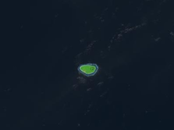
 Satellite picture | |
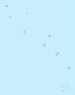
 Map of the island | |
| Coordinates: 10°47′21″S 179°28′23″E / 10.78917°S 179.47306°E | |
| Country | Tuvalu |
| Area | |
• Total | 0.40 km2 (0.15 sq mi) |
| Elevation | 4.6 m (15.1 ft) |
| Population (2017) | |
• Total | 34 |
| • Density | 85/km2 (220/sq mi) |
Niulakita is the southernmost island of Tuvalu,[1] and also the name of the only village on this island. Niulakita has a population of 34 (2017 Census).[2] The residents of Niulakita have moved to the island from Niutao. Niulakita is represented in the Parliament of Tuvalu by the members of the constituency of Niutao.
- ^ "Maps of Tuvalu". Retrieved 15 January 2021.
- ^ "Population of communities in Tuvalu". Thomas Brinkhoff. 2017. Retrieved 27 September 2020.
