Back উত্তর-পশ্চিম সীমান্ত প্রদেশ Bengali/Bangla North West Frontier German Nordokcidenta Limprovinco Esperanto Frontera del Noroeste Spanish उत्तर-पश्चिम सीमांत प्रांत Hindi Provincia della frontiera nord-occidentale Italian Província da Fronteira Noroeste Portuguese Северо-Западная пограничная провинция (Британская Индия) Russian வடமேற்கு எல்லைப்புற மாகாணம் (1901-2010) Tamil Lalawigan ng North West Frontier Tagalog
| North-West Frontier Province | |||||||||||||||||||||||
|---|---|---|---|---|---|---|---|---|---|---|---|---|---|---|---|---|---|---|---|---|---|---|---|
| Province of British India (1901–1947) Pakistan (1947–1955; 1970–2010) | |||||||||||||||||||||||
| 1901-1955; 1970–2010 | |||||||||||||||||||||||
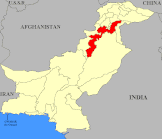
 1947–1955 1970–2010 Location within Pakistan | |||||||||||||||||||||||
| Capital | Peshawar | ||||||||||||||||||||||
| Area | |||||||||||||||||||||||
• 1901 | 100,142[1][2] km2 (38,665 sq mi) | ||||||||||||||||||||||
| Population | |||||||||||||||||||||||
• 1901 | 2,041,534 | ||||||||||||||||||||||
| History | |||||||||||||||||||||||
| 9 November 1901 | |||||||||||||||||||||||
| 14 August 1947 | |||||||||||||||||||||||
| 14 October 1955 | |||||||||||||||||||||||
| 1 July 1970 | |||||||||||||||||||||||
| 19 April 2010 | |||||||||||||||||||||||
| |||||||||||||||||||||||
| Today part of | Pakistan · Khyber Pakhtunkhwa | ||||||||||||||||||||||
 |
| This article is part of the series |
| Former administrative units of Pakistan |
|---|
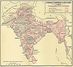
The North-West Frontier Province (NWFP; Pashto: شمال لویدیځ سرحدي ولایت, Urdu: شمال مغربی سرحدی صوبہ) was a province of British India from 1901 to 1947, of the Dominion of Pakistan from 1947 to 1955, and of the Islamic Republic of Pakistan from 1970 to 2010. It was established on 9 November 1901 from the north-western districts of the British Punjab, during the British Raj.[3] Following the referendum in 1947 to join either Pakistan or India, the province voted hugely in favour of joining Pakistan and it acceded accordingly on 14 August 1947. It was dissolved to form a unified province of West Pakistan in 1955 upon promulgation of One Unit Scheme and was reestablished in 1970. It was known by this name until 19 April 2010, when it was dissolved and redesignated as the province of Khyber Pakhtunkhwa following the passing of the Eighteenth Amendment to the Constitution of Pakistan, by President Asif Ali Zardari.
The province covered an area of 70,709 km2 (27,301 sq mi), including much of the current Khyber Pakhtunkhwa province but excluding the Federally Administered Tribal Areas and the former princely states of Amb, Chitral, Dir, Phulra and Swat. Its capital was the city of Peshawar, and the province was composed of six divisions (Bannu, Dera Ismail Khan, Hazara, Kohat, Mardan, and Peshawar Division; Malakand was later added as the seventh division). Until 1947, the province was bordered by five princely states to the north, the minor states of the Gilgit Agency to the northeast, the province of Punjab to the east and the province of Balochistan to the south. The Kingdom of Afghanistan lay to the northwest, with the Federally Administered Tribal Areas forming a buffer zone between the two.
- ^ Area with Native States in 1901. Province area excluding Native States was 34 169 km2 (13 193 sq mi).
- ^ The Imperial Gazetteer of India 1908, p. 46.
- ^ Shāh, Sayyid Vaqār ʻAlī (2007). North-West Frontier Province: History and Politics. National Institute of Historical & Cultural Research, Centre of Excellence, Quaid-i-Azam University. p. 15. ISBN 978-969-415-084-0.


