Back نورث باتلفورد Arabic نورث باتلفورد ARZ North Battleford ATJ North Battleford Catalan North Battleford CEB North Battleford Czech North Battleford German North Battleford Esperanto North Battleford Spanish بتلفورد شمالی Persian
North Battleford | |
|---|---|
| City of North Battleford | |
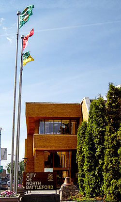
 North Battleford City Hall | |
| Coordinates: 52°45′27″N 108°17′10″W / 52.75750°N 108.28611°W | |
| Country | Canada |
| Province | Saskatchewan |
| Census division | 16 |
| Village | 1906 |
| Town | 1907 |
| City | 1913 |
| Government | |
| • Mayor | David Gillan |
| • MLA | Jeremy Cockrill (SKP) |
| • MP | Rosemarie Falk (CON) |
| Area | |
| • Land | 33.55 km2 (12.95 sq mi) |
| • Metro | 1,122.99 km2 (433.59 sq mi) |
| Population (2011)[1] | |
| • City | 13,888 |
| • Density | 414.0/km2 (1,072/sq mi) |
| • Metro | 19,216 |
| • Metro density | 17.1/km2 (44/sq mi) |
| Time zone | UTC−6 (CST) |
| Forward sortation area | |
| Area code(s) | 306, 639 |
| Website | www |
| [2][3] | |
North Battleford is a city in west-central Saskatchewan, Canada. It is the seventh largest city in the province and is directly across the North Saskatchewan River from the Town of Battleford. Together, the two communities are known as "The Battlefords". North Battleford borders the Rural Municipality of North Battleford No. 437, as well as the North Battleford Crown Colony (census subdivision).[4]
Situated immediately north of the mouth of the Battle River, North Battleford and the greater Battlefords area are a notable stop along the Yellowhead Highway, part of the Trans-Canada system, and serve as a commercial and cultural hub for west- and north-central Saskatchewan. Together, the Battlefords are served by the Yellowhead Highway as well as Highway 4, Highway 26, Highway 29, and Highway 40.
Battlefords Provincial Park[5] is 40 kilometres (25 mi) north on Highway 4.
- ^ "2011 Community Profiles". Statistics Canada. Government of Canada. Retrieved 6 December 2013.
- ^ National Archives, Archivia Net. "Post Offices and Postmasters". Retrieved 6 December 2013.
- ^ Government of Saskatchewan, MRD Home. "Municipal Directory System". Retrieved 6 December 2013.
- ^ geodepot.statcan.ca
- ^ The Battlefords Provincial Park


