Back Agrida AN أوخريد Arabic اوخريد ARZ Oxrid Azerbaijani Охрид Bashkir Охрыд Byelorussian Охрыд BE-X-OLD Охрид Bulgarian Ohrid BS Okhrida Catalan
41°07′01″N 20°48′06″E / 41.11694°N 20.80167°E
Ohrid
Охрид (Macedonian) | |
|---|---|
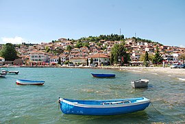
Ohrid and Lake Ohrid | |
|
| |
| Nickname(s): | |
| Coordinates: 41°07′01″N 20°48′06″E / 41.11694°N 20.80167°E | |
| Country | |
| Region | |
| Municipality | |
| Government | |
| • Mayor | Kiril Pecakov (VMRO-DPMNE) |
| Area | |
| • Total | 383.93 km2 (148.24 sq mi) |
| Elevation | 695 m (2,280 ft) |
| Population (2021) | |
| • Total | 38 818 [4] |
| Time zone | UTC+1 (CET) |
| Postal codes | 6000 |
| Area code | +389 046 |
| Climate | Cfb |
| Patron saints | Saint Clement and Saint Naum |
| Website | https://ohrid.gov.mk |
| Official name | Natural and Cultural Heritage of the Ohrid region |
| Type | Natural, Cultural |
| Criteria | i, iii, iv, vii |
| Designated | 1979 (3rd session) |
| Reference no. | 99 |
| Region | Europe and North America |
| Extensions | 1980, 2019 |
Ohrid (Macedonian: Охрид [ˈɔxrit] ) is a city in North Macedonia and is the seat of the Ohrid Municipality. It is the largest city on Lake Ohrid and the eighth-largest city in the country, with the municipality recording a population of over 42,000 inhabitants as of 2002. Ohrid is known for once having 365 churches,[5] one for each day of the year, and has been referred to as the "Jerusalem of the Balkans".[2][6] The city is rich in picturesque houses and monuments, and tourism is predominant. It is located southwest of Skopje, west of Resen and Bitola. In 1979 and in 1980, respectively, Ohrid and Lake Ohrid were accepted as Cultural and Natural World Heritage Sites by UNESCO. Ohrid is one of only 40 sites that are part of UNESCO's World Heritage that are Cultural as well as Natural sites.[7]
- ^ Press online Archived 11 January 2010 at the Wayback Machine Gradovi u jesen (in Serbian)
- ^ a b "The Mirror of the Macedonian Spirit, Zlate Petrovski, Sašo Talevski, Napredok, 2004, ISBN 978-9989-730-38-2, page 72: "... and Macedonia in the Cathedral Church St. Sofia in the Macedonian Jerusalem — Ohrid..."
- ^ Dnevnik newspaper - Interview with the ambassador of Israel to Macedonia Archived 28 September 2011 at the Wayback Machine (in Macedonian)
- ^ "Total resident population of the Republic of North Macedonia by ethnic affiliation, by settlement, Census 2021".
- ^ Thomas, Anjaly (24 June 2021). "Ohrid: The city with a church for everyday of the year". khaleejtimes.com. Khaleej Times. Retrieved 3 July 2024.
- ^ Biljana Vankovska; Hakan Wiberg; Wiberg Hakan (2003). Between Past and Future: Civil-military Relations in the Post-communist Balkans. Bloomsbury Academic. p. 71. ISBN 978-1-86064-624-9.
- ^ Natural and Cultural Heritage of the Ohrid region


