Back Reserva índia Omaha Catalan Reserva india Omaha Spanish Réserve Omaha French Reserva india Omaha Galician Омаха (индейская резервация) Russian
Omaha Reservation
Umoⁿhoⁿ tóⁿde ukʰéthiⁿ (Omaha–Ponca) | |
|---|---|
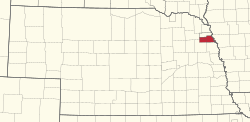
 Location of the Omaha Reservation in Nebraska | |
Location in the United States | |
| Coordinates: 42°05′33″N 96°32′09″W / 42.09250°N 96.53583°W | |
| Tribe | Omaha |
| Country | United States |
| State | Nebraska and Iowa |
| County | Thurston County, Nebraska, Cuming County, Nebraska, Burt County, Nebraska and Monona County, Iowa |
| Headquarters | Macy |
| Area | |
| • Total | 309.993 sq mi (802.88 km2) |
| • Land | 307.032 sq mi (795.21 km2) |
| • Water | 2.961 sq mi (7.67 km2) |
| Population | |
| • Total | 4,526 |
| • Density | 14.7/sq mi (5.7/km2) |
| Website | Omaha Tribe of Nebraska |
The Omaha Reservation (Omaha–Ponca: Umoⁿhoⁿ tóⁿde ukʰéthiⁿ) of the federally recognized Omaha tribe is located mostly in Thurston County, Nebraska, with sections in neighboring Cuming and Burt counties, in addition to Monona County in Iowa. As of the 2020 federal census, the reservation population was 4,526.[2] The tribal seat of government is in Macy.[3] The villages of Rosalie, Pender and Walthill are located within reservation boundaries, as is the northernmost part of Bancroft. Due to land sales in the area since the reservation was established, Pender has disputed tribal jurisdiction over it, to which the Supreme Court ruled unanimously in 2016 that "the disputed land is within the reservation’s boundaries."[4][5]
- ^ Cite error: The named reference
gaz2020was invoked but never defined (see the help page). - ^ a b Cite error: The named reference
2020-census-2550was invoked but never defined (see the help page). - ^ "Omaha Tribe" Archived 2007-07-29 at the Wayback Machine, Nebraska Indian Commission. Retrieved 6/28/08.
- ^ "Nebraska v. Parker, 14-1406" (PDF). supremecourt.gov.
- ^ Durocher, Skip; Nichols, James & Streitz, Mary (March 25, 2016). "Supreme Court Unanimously Holds that Omaha Tribe's Reservation Not Diminished by 1882 Statute". Minneapolis, MN: Dorsey & Whitney LLP. Retrieved 28 March 2016.

