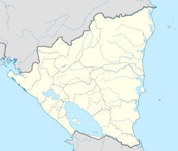
Back ኦሜቴፔ ደሴት Amharic أوميتيبي Arabic اوميتيبى ARZ Ometepe Breton Isla de Ometepe CEB Ometepe Czech Ometepe German Ομετέπε Greek Ometepe Esperanto Ometepe Spanish
 | |
| Geography | |
|---|---|
| Location | Lake Nicaragua (Lake Cocibolca) |
| Coordinates | 11°30′N 85°35′W / 11.500°N 85.583°W |
| Total islands | 1 |
| Major islands | 1 |
| Area | 276 km2 (107 sq mi) |
| Length | 31 km (19.3 mi) |
| Width | 10 km (6 mi) |
| Highest elevation | 1,610 m (5280 ft) |
| Highest point | Concepción |
| Administration | |
| Department | Rivas |
| Largest settlement | Altagracia (pop. 4,081) |
| Demographics | |
| Population | 29,684 (June 2005) |
| Pop. density | 107.6/km2 (278.7/sq mi) |
Ometepe is an island formed by two volcanoes rising out of Lake Nicaragua, located in the Rivas Department of the Republic of Nicaragua. Its name derives from the Nahuatl words ome (two) and tepetl (mountain), meaning "two mountains".[1] It is the largest island in Lake Nicaragua.
The two volcanoes (Concepción and Maderas) are joined by a low isthmus to form one island. Ometepe has an area of 276 square kilometres (107 sq mi). It is 31 kilometres (19 mi) long and 5 to 10 kilometres (3.1 to 6.2 mi) wide.[2] The island has an economy based on livestock, agriculture, and tourism. Plantains are the major crop.
- ^ Cerna, Celeste (August 4, 2016). "Unite a la aventura y explorá la Isla de Ometepe" [Join the adventure and explore the Island of Ometepe]. El Nuevo Diario (in Spanish). Archived from the original on December 15, 2019. Retrieved July 27, 2017.
- ^ "Tourism: Island of Ometepe". EAAI. Archived from the original on 2007-06-10. Retrieved 2007-10-19.
