Back Xarici Seyşel adaları Azerbaijani Illes Exteriors de Seychelles Catalan Vnější ostrovy Czech Outer Islands (Seychellen) German Islas Exteriores Spanish Korallisaared Estonian جزایر بیرونی (سیشل) Persian Îles Extérieures French Outer Islands (Seychelles) ID Isole Esterne Italian
Nickname: Zil Elwannyen Sesel | |
|---|---|
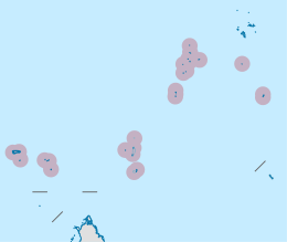
 Location map of the Outer Islands of the Seychelles archipelago in the western Indian Ocean | |
| Geography | |
| Location | Indian Ocean |
| Coordinates | 5°58′S 53°03′E / 5.967°S 53.050°E |
| Archipelago | Seychelles |
| Adjacent to | Indian Ocean |
| Total islands | 200 |
| Major islands | |
| Area | 216.57 km2 (83.62 sq mi) |
| Highest elevation | 35 m (115 ft) |
| Highest point | unnamed dune |
| Administration | |
| Group | Outer Islands |
| Districts | Outer Islands District |
| Largest settlement | Coëtivy Island (pop. 260) |
| Demographics | |
| Population | 574 (estimate) (2019)[1] |
| Pop. density | 3.23/km2 (8.37/sq mi) |
| Ethnic groups | Creole, French, East Africans, Indians. |
| Additional information | |
| Time zone | |
| ISO code | SC-26 |
| Official website | www |
The Outer Islands or Coralline Seychelles (archipelago) is a collective term for those islands of the Seychelles that are not on the shallow Seychelles Bank (Seychelles Plateau) which defines the location of the granitic Inner Islands archipelago to the east. The local Seychellois Creole name for the outer islands is Zil Elwannyen Sesel, while the French name is Îles Eloignées. They are all of coral formation, and in the western Indian Ocean.
- ^ "POPULATION AND VITAL STATISTICS MID YEAR POPULATION ESTIMATES 2019". Statistical Bulletin. Victoria, Mahe, Seychelles: National Bureau of Statistics Seychelles. 2019-08-30. p. 17 (Table 10). Retrieved 2020-01-08.