Back جبل پين واى فان ARZ Pen y Fan Breton Pen y Fan Czech Pen y Fan Welsh Pen y Fan Danish Pen y Fan German Pen y Fan Estonian Pen y Fan Basque Pen y Fan French Pen y Fan Irish
| Pen y Fan | |
|---|---|
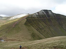
 Pen y Fan from Cribyn | |
| Highest point | |
| Elevation | 886 m (2,907 ft) |
| Prominence | 672 m (2,205 ft) |
| Listing | Marilyn, Hewitt, Council top, Nuttall |
| Coordinates | 51°53′00″N 3°26′13″W / 51.88328°N 3.43684°W |
| Naming | |
| English translation | Top of the peak |
| Language of name | Welsh |
| Pronunciation | Welsh: [ˌpɛnəˈvan] |
| Geography | |
Pen y Fan in the Brecon Beacons National Park (green area) | |
| Location | Powys, Wales |
| Parent range | Brecon Beacons |
| OS grid | SO012215 |
| Topo map | OS Landranger 160, Explorer OL12 |
Pen y Fan (Welsh pronunciation: [ˌpɛn ə ˈvan]) is the highest peak in South Wales, situated in Brecon Beacons National Park (Bannau Brycheiniog). At 886 metres (2,907 ft) above sea-level, it is also the highest British peak south of Cadair Idris in Snowdonia. It is the highest point (county top) of the historic county of Brecknockshire (though in modern administrative terms, it now lies within the unitary council area of Powys). The twin summits of Pen y Fan and Corn Du at 873 metres (2,864 ft) were formerly referred to as Cadair Arthur or 'Arthur's Seat'.[1]
The mountain and surrounding area are owned by the National Trust whose work parties attempt to combat the erosion caused by the popularity of this peak with walkers. The mountain is used by the military as part of the selection process of the UK's Special Forces personnel. Three soldiers who died after collapsing in the field in July 2013 were taking part in a test march called Point-to-Point while undergoing Special Air Service selection.[2][3]
- ^ Nuttall, John & Anne (1999). The Mountains of England & Wales - Volume 1: Wales (2nd edition ed.). Milnthorpe, Cumbria: Cicerone. ISBN 1-85284-304-7.
- ^ "Cpl James Dunsby suffered organ failure after SAS Brecon Beacons training". BBC News. 8 August 2013.
- ^ "Brecon Beacons deaths: relatives attack failure to prosecute senior officers". The Guardian. 18 September 2018. Retrieved 2 July 2022.