Back Axarbaxar (dağ) Azerbaijani Porak Catalan Porak German Porak Spanish پوراک Persian Porak French Porak Irish Փորակ Armenian Porak ID Porak Italian
| Porak | |
|---|---|
| Axarbaxar | |
 A pyroclastic cone of the Porak volcanic field. | |
| Highest point | |
| Elevation | 2,800 m (9,200 ft) |
| Listing | |
| Coordinates | 40°01′N 45°47′E / 40.017°N 45.783°E |
| Geography | |
| Countries | |
| Parent range | Vardenis |
| Geology | |
| Mountain type | Stratovolcano |
| Last eruption | 778 BCE ± 5 years |
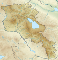
Porak or Akharbakhar ("gutted belly" in Azerbaijani[1]) is a stratovolcano located in the Vardenis volcanic ridge. It lies about 20 km (12 mi) southeast of Lake Sevan and the volcanic field spans the border between Armenia and Azerbaijan with lava flows running into both countries. Ten satellite cones and fissure vents lie on the flanks of the volcano.[2]
The Porak volcano itself and the third stage has been dated 15 ± 15 ka by K-Ar dating.[1] Two long lava flows, one of which 21 km long, stretch from the field north and northeastwards. There are thermal springs in the area, and the Middle Pleistocene Khonarassar fault area lies to the north of the Porak centre.[3][4] The Karkar volcanoes are situated in the same region.[5] The complex is built on partly sedimentary rock and partly volcanogenic Late Cretaceous and Eocene series with Paleogene intrusions.[1]
- ^ a b c Bubnov, S. N.; Lebedev, V. A.; Chernyshev, I. V.; Sagatelyan, A. K.; Dokuchaev, A. Ya.; Gol’tsman, Yu. V.; Oleinikova, T. I.; Griboedova, I. G. (2014). "The potentially active Porak neovolcanic center (Lesser Caucasus, Armenia): The composition of lavas and melt sources". Doklady Earth Sciences. 459 (1): 1365–1370. Bibcode:2014DokES.459.1365B. doi:10.1134/S1028334X14110014. ISSN 1028-334X. S2CID 131294219.
- ^ "Porak". Global Volcanism Program. Smithsonian Institution. Retrieved 20 July 2015.
- ^ Cite error: The named reference
KarakhanianDjrbashian2002was invoked but never defined (see the help page). - ^ "Porak". Search. Volcano Global Risk Identification & Analysis Project. May 2, 2012. Retrieved July 21, 2015.
- ^ Cite error: The named reference
Meliketsian2021was invoked but never defined (see the help page).

