Back بكبسي Arabic بكبسى ARZ پوکیپسی، نیویورک AZB Пъкипсий Bulgarian Poughkeepsie (Nova York) Catalan Поукипзи (Нью-Йорк) CE Poughkeepsie CEB Poughkeepsie Czech Poughkeepsie, Efrog Newydd Welsh Poughkeepsie DAG
Poughkeepsie, New York | |
|---|---|
 Poughkeepsie during its annual balloon festival | |
| Etymology: U-puku-ipi-sing: "The reed-covered lodge by the little-water place"[1] | |
| Nickname(s): The Queen City of the Hudson, PK[2]: 207 | |
 Interactive map of Poughkeepsie | |
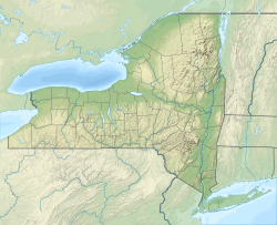
| Coordinates: 41°42′N 73°56′W / 41.70°N 73.93°W | |
| Country | |
| State | New York |
| County | Dutchess |
| Founded | 1686 |
| Incorporated (town) | 1799 |
| Incorporated (city) | 1854 |
| Government | |
| • Type | Mayor–council government |
| • Mayor | Yvonne Flowers (D) |
| • Common Council | |
| Area | |
• City | 5.72 sq mi (14.81 km2) |
| • Land | 5.14 sq mi (13.32 km2) |
| • Water | 0.57 sq mi (1.49 km2) |
| • Urban | 327.1 sq mi (847.3 km2) |
| Elevation | 180 ft (50 m) |
| Highest elevation (College Hill) | 380 ft (120 m) |
| Lowest elevation | 0 ft (0 m) |
| Population (2020) | |
• City | 31,577 |
| • Density | 6,137.41/sq mi (2,369.86/km2) |
| • Urban | 314,766 (US: 131st)[4] |
| • Urban density | 1,499.4/sq mi (578.9/km2) |
| • Metro | 697,221 (US: 84th) |
| Time zone | UTC−5 (EST) |
| • Summer (DST) | UTC−4 (EDT) |
| ZIP Codes | 12601–12604 |
| Area code | 845 |
| FIPS code | 36-59641 |
| GNIS feature ID | 979392[5] |
| Website | www |
Poughkeepsie (/pəˈkɪpsi/ pə-KIP-see), officially the City of Poughkeepsie, which is separate from the Town of Poughkeepsie around it, is a city in the U.S. state of New York. It is the county seat of Dutchess County, with a 2020 census population of 31,577.[6] Poughkeepsie is in the Hudson River Valley region, midway between the core of the New York metropolitan area and the state capital of Albany. It is a principal city of the Kiryas Joel–Poughkeepsie–Newburgh metropolitan area which belongs to the New York combined statistical area.[7] It is served by the nearby Hudson Valley Regional Airport and Stewart International Airport in Orange County, New York.
Poughkeepsie has been called "The Queen City of the Hudson".[8] It was settled in the 17th century by the Dutch and became New York State's second capital shortly after the American Revolution. It was chartered as a city in 1854. Major bridges in the city include the Walkway over the Hudson, a former railroad bridge called the Poughkeepsie Bridge which reopened as a public walkway on October 3, 2009; and the Mid-Hudson Bridge, a major thoroughfare built in 1930 that carries U.S. Route 44 over the Hudson. The city of Poughkeepsie lies in New York's 18th congressional district.[9]
The City of Poughkeepsie and neighboring Town of Poughkeepsie are generally viewed as a single place and are commonly referred to collectively as "Poughkeepsie", with a combined population of 77,048 in 2020.[6][10]
Poughkeepsie is situated between the Lower Hudson and the Capital District regions, and the city's economy is stimulated by several major corporations, including IBM. Educational institutions include Marist College, Vassar College, Dutchess Community College and The Culinary Institute of America.
- ^ Buff, Sheila (April 1, 2009). Insider's guide to the Hudson River Valley. Morris Book Publishing. p. 6. ISBN 978-0762744381.
- ^ Adams, Arthur G. (1996). The Hudson River Guidebook (2nd ed.). New York: Fordham University Press. ISBN 0-8232-1679-9. LCCN 96-1894. Retrieved March 23, 2019.
- ^ "ArcGIS REST Services Directory". United States Census Bureau. Archived from the original on January 19, 2022. Retrieved September 20, 2022.
- ^ United States Census Bureau (December 29, 2022). "2020 Census Qualifying Urban Areas and Final Criteria Clarifications". Federal Register. Archived from the original on December 30, 2022. Retrieved January 2, 2023.
- ^ U.S. Geological Survey Geographic Names Information System: Poughkeepsie, New York
- ^ a b "April 1,2020 Census QuickFacts Poughkeepsie city, New York". census.gov. Archived from the original on September 30, 2023. Retrieved January 29, 2022.
- ^ United States Office of Management and Budget (September 14, 2018). "OMB Bulletin No. 18-04" (PDF). Archived (PDF) from the original on July 26, 2019. Retrieved July 11, 2019.
- ^ McQuill, Thursty (1884). The Hudson River by Daylight. Bryant Literary Union. p. 40. Archived from the original on September 30, 2023. Retrieved November 14, 2019.
- ^ [1] Archived April 12, 2015, at the Wayback Machine, Detailed Map of 18th Congressional District
- ^ "ACS 2018 Demographic and Housing Estimates for Poughkeepsie Township". data.census.gov. Archived from the original on August 6, 2020. Retrieved February 2, 2020.


