Back حديقة قوستك الوطنية Arabic Taman Nasional Qausuittuq BAN Qausuittuq-Nationalpark German Parque nacional Qausuittuq Spanish Parc national Qausuittuq French Parco nazionale Qausuittuq Italian Kvasuituko nacionalinis parkas Lithuanian Куасуиттук Russian Vườn quốc gia Qausuittuq Vietnamese 考苏伊图克国家公园 Chinese
| Qausuittuq National Park | |
|---|---|
| Parc national Qausuittuq | |
 Caribou in Qausuittuq National Park | |
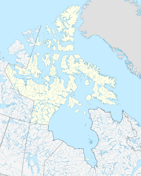
Location in Canada | |
| Location | Nunavut Canada |
| Nearest city | Resolute |
| Coordinates | 76°00′N 100°00′W / 76.000°N 100.000°W |
| Area | greater than 11,000 km2 (4,200 sq mi) |
| Established | September 1, 2015 |
| Governing body | Parks Canada |
 | |
Qausuittuq National Park (pronounced Qow-soo-ee-tooq, from Inuktitut meaning place where the sun does not rise) is a national park located on northwest Bathurst Island in Nunavut.[1][2] It was established on September 1, 2015, becoming Canada's 45th national park.[3]
This area was chosen to represent the Western High Arctic natural region, one of 39 such regions identified by Parks Canada. This region encompasses most of the high Arctic Archipelago (the Queen Elizabeth Islands and the Grinnell Peninsula on Devon Island, but not Ellesmere Island or Axel Heiberg Island). The park also protects important Peary caribou habitat. It is north of the existing Polar Bear Pass National Wildlife Area.
- ^ "National Park System Plan, 3rd Edition". Parks Canada. Archived from the original on August 7, 2014. Retrieved August 15, 2014.
- ^ "Qausuittuq National Park Proposal, Bathurst Island, Nunavut" (PDF). Parks Canada. 12 December 2012. Archived from the original (PDF) on 19 August 2014. Retrieved August 15, 2014.
- ^ "High-Arctic National Park Created on Bathurst Island". Parks Canada. June 24, 2015. Retrieved June 26, 2015.

