Back راجشاهي Arabic راجشاهى ARZ Раджшахі Byelorussian রাজশাহী Bengali/Bangla Rajshahi Catalan Rājshāhi (kapital sa lalawigan sa Bangladesh) CEB Rajshahi Danish Rajshahi German Ρατζσάχι Greek Raĝŝaho Esperanto
Rajshahi
রাজশাহী | |
|---|---|
Skyline of Rajshahi City Administration Building of Rajshahi College | |
| Nickname(s): Education City, Silk City, City of Mango, Green City, Clean City, City of Peace | |
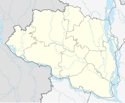
Location of Rajshahi in Rajshahi division | |
| Coordinates: 24°22′N 88°36′E / 24.367°N 88.600°E | |
| Country | |
| Division | Rajshahi |
| District | Rajshahi |
| Establishment | 1634 |
| Municipality | 1876 |
| Granted city status | 1991 |
| Government | |
| • Type | Mayor-Council |
| • Body | Rajshahi City Corporation |
| • Administrator | Dr. Dewan Muhammad Humayun Kabir (None currently) |
| • Police Commissioner | Muhammad Abu Sufian |
| Area | |
• City corporation | 120.98 km2 (46.71 sq mi) |
| • Rank | 4th |
| Elevation | 18 m (59 ft) |
| Population (2024)[3] | |
• City corporation | 553,288 |
| • Density | 4,600/km2 (12,000/sq mi) |
| • City rank | 6th in Bangladesh |
| • Metro rank | 6th in Bangladesh |
| Demonym | Rajshahian |
| Languages | |
| • Official | Bengali • English |
| GDP | |
| • Nominal | $23 billion |
| • Per Capita | $3130 |
| • Rank in BD | 4th |
| Time zone | UTC+6 (BST) |
| Postal code | 6000, 6100, 6203 |
| UN/LOCODE | BD RJH |
| Calling Code old | 0721 |
| Calling Code new | 025888 |
| Police | Rajshahi Metropolitan Police |
| Airport | Shah Makhdum Airport |
| Metropolitan Planning Authority | Rajshahi Development Authority |
| Water Supply and Sewerage Authority | Rajshahi WASA |
| Website | rajshahi |
Rajshahi (Bengali: রাজশাহী, [radʒ.ʃaɦi]) is a metropolitan city and a major urban, administrative, commercial and educational centre of Bangladesh. It is also the administrative seat of the eponymous division and district. Located on the north bank of the Padma River, near the Bangladesh–India border, the city is surrounded by the satellite towns of Nowhata and Katakhali, which together build an urban agglomeration of about 1 million population.[4][5] Modern Rajshahi lies in the ancient region of Pundravardhana. The foundation of the city dates to 1634, according to epigraphic records at the mausoleum of Sufi saint Shah Makhdum. The area hosted a Dutch settlement in the 18th century.[6] The Rajshahi municipality was constituted during the British Raj in 1876. It was the divisional capital of the greater Rajshahi division which was the largest division in Bengal Province.
Rajshahi is a historic center of silk production. Varendra Research Museum, the oldest of its kind in Bangladesh, is located in the city. Sometimes the city is referred as the City of Education.[7] The city is home to many renowned educational institutions of Bangladesh. The head office of Rajshahi Agricultural Development Bank and Barind Multipurpose Development Authority (BMDA) is situated in the city. The Shah Makhdum Airport serves Rajshahi. According to The Guardian, Rajshahi is the cleanest city of Bangladesh.[8]
- ^ "Area, Population and Literacy Rate by Paurashava −2001" (PDF). Bangladesh Bureau of Statistics. Archived from the original (PDF) on 17 December 2008. Retrieved 19 August 2009.
- ^ "PM opens 8 new police stations in Rajshahi". Rising Sun. 22 February 2018. Retrieved 15 September 2018.
- ^ Cite error: The named reference
2022censuswas invoked but never defined (see the help page). - ^ "Rajshahi (Bangladesh): City Districts and Subdistricts – Population Statistics in Maps and Charts".
- ^ "Rajshahi Population 2024".
- ^ "Rajshahi – Bangladesh".
- ^ "Rajshahi will be the city of entrepreneurs in 5 years". The Business Standard. 28 January 2022. Retrieved 20 May 2023.
- ^ "Rajshahi: the city that took on air pollution – and won". the Guardian. 17 June 2016. Retrieved 6 October 2022.


