Riddoch Highway | |
|---|---|
 | |
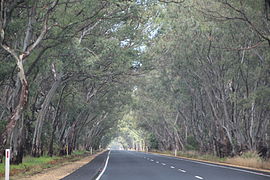
| The Riddoch Highway near Padthaway | |
 | |
| Coordinates | |
| General information | |
| Type | Highway |
| Length | 239 km (149 mi)[1] |
| Route number(s) |
|
| Major junctions | |
| North end | Keith, South Australia |
| |
| South end | Sea Parade Port MacDonnell, South Australia |
| Location(s) | |
| Region | Limestone Coast[2] |
| Major settlements | Padthaway, Naracoorte, Coonawarra, Penola, Tarpeena, Mount Gambier |
| Highway system | |
| ---- | |
Riddoch Highway is a rural highway in south-eastern South Australia, designated as route A66 between Keith and Mount Gambier, with the remainder between Mount Gambier and Port MacDonnell designated as route B66. It is named after John Riddoch, the first white settler landholder and vigneron in Coonawarra.
- ^ "Riddoch Highway" (Map). Google Maps. Retrieved 6 June 2022.
- ^ "Location SA Map viewer with regional layers". Government of South Australia. Retrieved 16 June 2022.

