Back Rotorua Afrikaans Rotorua AN روتوروا Arabic روتوروا ARZ Ратаруа Byelorussian Роторуа Bulgarian Rotorua Catalan Rotorua (kapital sa distrito sa New Zealand) CEB Rotorua Czech Rotorua Welsh
Rotorua
Te Rotorua-nui-a-Kahumatamomoe (Māori) | |
|---|---|
| Nickname(s): | |
| Motto: Tātau tātau[3] | |
| Coordinates: 38°08′16″S 176°15′05″E / 38.13778°S 176.25139°E | |
| Country | New Zealand |
| Region | Bay of Plenty |
| Territorial authority | Rotorua Lakes Council |
| Settled by Māori | c. 1350 |
| Founded | c. 1350 |
| Borough status | 1922 |
| City status | 1962 |
| City status revoked | 1989 |
| Electorate | Rotorua |
| Government | |
| • Mayor | Tania Tapsell |
| Area | |
| • Territorial | 2,614.9 km2 (1,009.6 sq mi) |
| • Urban | 46.06 km2 (17.78 sq mi) |
| • Metro | 89.28 km2 (34.47 sq mi) |
| Elevation | 280 m (920 ft) |
| Population (June 2024)[4] | |
| • Territorial | 77,800 |
| • Density | 30/km2 (77/sq mi) |
| • Urban | 58,800 |
| • Urban density | 1,300/km2 (3,300/sq mi) |
| • Metro | 58,800 |
| • Metro density | 660/km2 (1,700/sq mi) |
| Demonym | Rotoruan |
| Time zone | UTC+12 (NZST) |
| • Summer (DST) | UTC+13 (NZDT) |
| Postcode(s) | 3010, 3015 |
| Area code | 07 |
| Local iwi | Ngāti Whakaue, Te Arawa |
| Website | www |
Rotorua (Māori: [ˌɾɔtɔˈɾʉa][5]) is a city in the Bay of Plenty Region of New Zealand's North Island. It is sited on the southern shores of Lake Rotorua, from which it takes its name. It is the seat of the Rotorua Lakes District, a territorial authority encompassing Rotorua and several other nearby towns. It has an estimated resident population of 58,800, making it the country's 13th largest urban area, and the Bay of Plenty's second-largest urban area behind Tauranga.
Māori first settled in Rotorua in the 14th century, and a thriving pā was established at Ohinemutu by the people who would become Ngāti Whakaue. The city became closely associated with conflict during the Musket Wars of the 1820s. Ohinemutu was invaded by a Ngāpuhi-led coalition in 1823, commanded by Hongi Hika and Pōmare I. In the 19th century early European settlers had an interest in developing Rotorua, due to its unique geothermal activity in Rotorua and its surrounding area.[6] Then, efforts by Māori and Europeans alike to establish Rotorua as a spa town led to a 99-year lease of land from Ngāti Whakaue to the Government. The city first became a major site of tourism due to the Rotorua's close proximity to the Pink and White Terraces, until they were destroyed by the volcanic eruption of Mount Tarawera in 1886. Rotorua was elevated to borough status in 1922 and to city status 40 years later.
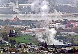
Rotorua is a major destination for both domestic and international tourists; the tourism industry is by far the largest industry in the district. It is known for its geothermal activity and Māori cultural tourism, and features geysers – notably the Pōhutu Geyser at Whakarewarewa – and hot mud pools. This thermal activity is sourced to the Rotorua Caldera, in which the town lies.
- ^ Cite error: The named reference
NZHerald3511691was invoked but never defined (see the help page). - ^ Corbett, Jan (20 January 2001). "Rumblings in geyserland". The New Zealand Herald. Archived from the original on 30 November 2019. Retrieved 7 June 2009.
- ^ "Coat of Arms – Rotorua Lakes Council". Rotorua Lakes Council. Archived from the original on 1 August 2023. Retrieved 13 August 2023.
- ^ Cite error: The named reference
NZ_population_data_2018was invoked but never defined (see the help page). - ^ "Rotorua – Te Aka Māori Dictionary". Rotorua – Te Aka Māori Dictionary. Archived from the original on 17 November 2021. Retrieved 23 July 2022.
- ^ "Rotorua District Council Ten Year Plan 2009-2019" (PDF). Rotorua Lakes Council. 1 July 2009. p. 33. Retrieved 19 March 2024.


