Back ساكوراي (نارا) Arabic ساکورای، نارا AZB Sakurai Catalan Сакураи CE Sakurai-shi CEB Sakurai (Nara) Czech Sakurai (Nara) German Sakurai (Nara) Spanish ساکورای، نارا Persian Sakurai Finnish
Sakurai
桜井市 | |
|---|---|
 Top:A panorama view of Mount Miwa and Yamato River, Second:Ōmiwa Shrine,
A heritage site of Hashihaka Tomb, Bottom:Hase Temple, Tanzan Shrine (all item from left to right) | |
 | |
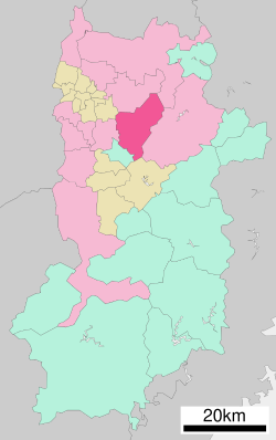
 Location of Sakurai in Nara Prefecture | |
| Coordinates: 34°31′N 135°51′E / 34.517°N 135.850°E | |
| Country | Japan |
| Region | Kansai |
| Prefecture | Nara Prefecture |
| First official recorded | 92 BC |
| Village settled | April 1, 1889 |
| Town settled | November 18, 1890 |
| City settled | September 1, 1956 |
| Government | |
| • Mayor | Akira Hasegawa |
| Area | |
| • Total | 98.92 km2 (38.19 sq mi) |
| Population (March 31, 2017) | |
| • Total | 58,386 |
| • Density | 590/km2 (1,500/sq mi) |
| Time zone | UTC+9 (Japan Standard Time) |
| Postal code(s) | 633-8585 |
| - Tree | Cryptomeria |
| - Flower | Prunus jamasakura |
| Phone number | 0744-42-9111 |
| Address | 432-1 Ōaza Ōdono 633-8585 |
| Website | www |
Sakurai (桜井市, Sakurai-shi) is a city located in Nara Prefecture, Japan. As of March 31, 2017, the city has an estimated population of 58,386, and 24,629 households.[1] The population density is 590 inhabitants per square kilometre (1,500/sq mi), and the total area is 98.92 square kilometres (38.19 sq mi).[2]
- ^ "Official website of Sakurai city" (in Japanese). Japan: Sakurai City. Retrieved 23 April 2017.
- ^ "面積および地勢" (PDF) (in Japanese). Japan: Sakurai City. Retrieved 23 April 2017.


