Back سان رافاييل (كاليفورنيا) Arabic سان رافاييل (كاليفورنيا) ARZ سان رافائل، کالیفورنیا AZB Сан Рафаел Bulgarian San Rafael (Califòrnia) Catalan Сан-Рафаель (Калифорни) CE San Rafael (kapital sa kondado sa Tinipong Bansa, California) CEB San Rafael (Kalifornie) Czech San Rafael DAG San Rafael (Kalifornien) German
San Rafael | |
|---|---|
|
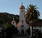
Clockwise: aerial view, St. Vincent's School, Dominican University of California, downtown San Rafael, Mission San Rafael Arcángel | |
| Nickname: The City With a Mission | |
 Location in California | |
| Coordinates: 37°58′25″N 122°31′52″W / 37.97361°N 122.53111°W | |
| Country | United States |
| State | California |
| County | Marin |
| Incorporated | February 18, 1874[1] |
| Named for | Archangel Raphael |
| Government | |
| • Type | Council-manager with directly elected mayor |
| • Mayor | Kate Colin[2] |
| • City Manager | Cristine Alilovich[3] |
| • Supervisor | District 1: Mary Sackett
District 2: Katie Rice District 4: Dennis Rodoni |
| • State Legislators[5] | Sen. Mike McGuire (D) Asm. Damon Connolly (D) |
| • U. S. Rep. | Jared Huffman (D)[4] |
| Area | |
| • City | 22.54 sq mi (58.4 km2) |
| • Land | 16.59 sq mi (43.0 km2) |
| • Water | 5.96 sq mi (15.4 km2) 26.42% |
| Elevation | 43 ft (13 m) |
| Population | |
| • City | 61,271 |
| • Density | 3,693.92/sq mi (1,426.23/km2) |
| • Urban | 246,548 (US: 165th)[7] |
| • Urban density | 2,897.2/sq mi (1,118.6/km2) |
| • Demonym | San Rafaelino |
| Time zone | UTC−8 (PST) |
| • Summer (DST) | UTC−7 (PDT) |
| ZIP code | 94901 |
| Area codes | 415/628 |
| FIPS code | 06-68364 |
| GNIS feature IDs | 1659589, 2411804 |
| Website | www |
San Rafael (/ˌsæn rəˈfɛl/ SAN rə-FEL; Spanish for "St. Raphael", Spanish pronunciation: [san rafaˈel]) is a city and the county seat of Marin County, California, United States. The city is located in the North Bay region of the San Francisco Bay Area. As of the 2020 U.S. census, the city's population was 61,271,[9] up from 57,713 in 2010.
San Rafael was founded by the Spanish in 1817, when Vicente Francisco de Sarría established Mission San Rafael Arcángel, initially as an asistencia (sub-mission). San Rafael Arcángel was upgraded to full mission status in 1822, a month before Alta California declared independence from Spain as part of Mexico. Following the American Conquest of California, the community of San Rafael incorporated as a city in 1874.
- ^ "California Cities by Incorporation Date". California Association of Local Agency Formation Commissions. Archived from the original (Word) on November 3, 2014. Retrieved August 25, 2014.
- ^ "Mayor & City Council". City of San Rafael. Retrieved December 10, 2020.
- ^ "City Manager's Office". City of San Rafael. Archived from the original on June 9, 2023. Retrieved August 15, 2023.
- ^ "California's 2nd Congressional District - Representatives & District Map". Civic Impulse, LLC.
- ^ "Statewide Database". UC Regents. Archived from the original on February 1, 2015. Retrieved January 18, 2015.
- ^ "2021 U.S. Gazetteer Files: California". United States Census Bureau. Retrieved July 5, 2022.
- ^ "List of 2020 Census Urban Areas". census.gov. United States Census Bureau. Retrieved January 7, 2023.
- ^ "San Rafael". Geographic Names Information System. United States Geological Survey, United States Department of the Interior.
- ^ a b "P1. Race – San Rafael city, California: 2020 DEC Redistricting Data (PL 94-171)". U.S. Census Bureau. Retrieved July 5, 2022.


