Back مقاطعة ساراسوتا (فلوريدا) Arabic ساراسوتا كاونتى (فلوريدا) ARZ Sarasota County, Florida BAR Сарасота (окръг, Флорида) Bulgarian সারাসোটা কাউন্টি, ফ্লোরিডা BPY Sarasota Gông (Florida) CDO Сарасота (гуо, Флорида) CE Sarasota County CEB Sarasota County, Florida Welsh Sarasota County German
Sarasota County | |
|---|---|
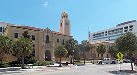
Images, from top down, left to right: Downtown Sarasota skyline; Van Wezel Performing Arts Hall on Sarasota's Bayfront; Sunset at Siesta Beach; Sarasota County Courthouse; Beachfront on Venice Beach; Front walkway of Ca' d'Zan | |
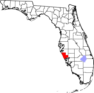
 Location within the U.S. state of Florida | |
 Florida's location within the U.S. | |
| Coordinates: 27°11′N 82°22′W / 27.19°N 82.37°W | |
| Country | |
| State | |
| Founded | May 14, 1921 |
| Seat | Sarasota |
| Largest city | North Port |
| Area | |
| • Total | 725 sq mi (1,880 km2) |
| • Land | 556 sq mi (1,440 km2) |
| • Water | 169 sq mi (440 km2) 23.4% |
| Population | |
| • Estimate (2023) | 469,013[1] |
| • Density | 781/sq mi (302/km2) |
| Time zone | UTC−5 (Eastern) |
| • Summer (DST) | UTC−4 (EDT) |
| ZIP Codes | 34223, 34229–34278, 34284–34289, 34292-34293, 34295 |
| Area code | 941 |
| Congressional district | 17th |
| Website | www |
Sarasota County is a county located in Southwest Florida. At the 2020 US census, the population was 434,006.[2] Its county seat is Sarasota[3] and its largest city is North Port. Sarasota County is part of the North Port–Bradenton–Sarasota, FL metropolitan statistical area.
- ^ "U.S. Census Bureau QuickFacts: Sarasota County, Florida; United States". www.census.gov. Retrieved March 18, 2024.
- ^ "QuickFacts for Sarasota County, Florida". U.S. Census Bureau. August 2021. Retrieved August 24, 2021.
- ^ "Find a County". National Association of Counties. Retrieved September 13, 2018.


