Back ساوساليتو (كاليفورنيا) Arabic ساسوليتو (كاليفورنيا) ARZ سائوسالیتو، کالیفورنیا AZB Сосалито Bulgarian Sausalito Catalan Саусалито CE Sausalito CEB Sausalito Czech Sausalito DAG Sausalito German
Sausalito, California | |
|---|---|
 Sausalito combines hillside with shoreline, as seen in this view from Bridgeway, the city's central street. | |
 Location in Marin County and the state of California | |
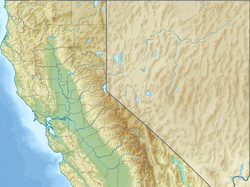
Location in the United States | |
| Coordinates: 37°51′33″N 122°29′07″W / 37.85917°N 122.48528°W | |
| Country | United States |
| State | California |
| County | Marin |
| Incorporated | September 4, 1893[1] |
| Government | |
| • Mayor | Ian Sobieski[2] |
| • State Senator | Mike McGuire (D)[3] |
| • Assemblymember | Damon Connolly (D)[3] |
| • U. S. Rep. | Jared Huffman (D)[4] |
| • Supervisor | District 3 Kate Sears |
| Area | |
| • Total | 2.26 sq mi (5.9 km2) |
| • Land | 1.76 sq mi (4.6 km2) |
| • Water | 0.49 sq mi (1.3 km2) 21.54% |
| Elevation | 10 ft (3 m) |
| Population | |
| • Total | 7,269 |
| • Density | 4,120.74/sq mi (1,591.03/km2) |
| Time zone | UTC−8 (PST) |
| • Summer (DST) | UTC−7 (PDT) |
| ZIP codes | 94965, 94966 |
| Area codes | 415/628 |
| FIPS code | 06-70364 |
| GNIS feature IDs | 277597, 2411834 |
| Website | www |
Sausalito (Spanish for "small willow grove") is a city in Marin County, California, United States, located 1.5 miles (2.4 kilometers) southeast of Marin City, 8 miles (13 km) south-southeast of San Rafael,[8] and about 4 miles (6 km) north of San Francisco from the Golden Gate Bridge.[6]
Sausalito's population was 7,269 as of the 2020 census.[7] The community is situated near the northern end of the Golden Gate Bridge, and prior to the building of that bridge served as a terminus for rail, car, and ferry traffic.
Sausalito developed rapidly as a shipbuilding center in World War II, with its industrial character giving way in postwar years to a reputation as a wealthy and artistic enclave, a picturesque residential community (incorporating large numbers of houseboats), and a tourist destination. The city is adjacent to, and largely bounded by, the protected spaces of the Golden Gate National Recreation Area as well as the San Francisco Bay.
- ^ "California Cities by Incorporation Date". California Association of Local Agency Formation Commissions. Archived from the original (Word) on November 3, 2014. Retrieved August 25, 2014.
- ^ "City Council". Sausalito, CA. Retrieved March 27, 2024.
- ^ a b "Statewide Database". UC Regents. Retrieved March 28, 2024.
- ^ "California's 2nd Congressional District - Representatives & District Map". Civic Impulse, LLC. Retrieved March 8, 2013.
- ^ "2021 U.S. Gazetteer Files: California". United States Census Bureau. Retrieved July 5, 2022.
- ^ a b "Sausalito". Geographic Names Information System. United States Geological Survey, United States Department of the Interior. Retrieved January 8, 2015.
- ^ a b "P1. Race – Sausalito city, California: 2020 DEC Redistricting Data (PL 94-171)". U.S. Census Bureau. Retrieved July 6, 2022.
- ^ Durham, David L. (1998). California's Geographic Names: A Gazetteer of Historic and Modern Names of the State. Clovis, Calif.: Word Dancer Press. p. 699. ISBN 1-884995-14-4.


