Back Seine Afrikaans Seine ALS ሰን ወንዝ Amharic Río Sena AN Sigen ANG السين (نهر) Arabic ܣܢ (ܢܗܪܐ) ARC سين (نهر فى فرنسا) ARZ Ríu Sena AST Sena çayı Azerbaijani
| Seine | |
|---|---|
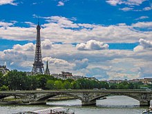
 The Seine in Paris | |
 Topographic map of the Seine basin | |
| Native name | la Seine (French) |
| Location | |
| Country | France |
| Physical characteristics | |
| Source | |
| • location | Source-Seine |
| Mouth | English Channel (French: la Manche) |
• location | Le Havre/Honfleur |
• coordinates | 49°26′02″N 0°12′24″E / 49.43389°N 0.20667°E |
• elevation | 0 m (0 ft) |
| Length | 777 km (483 mi) |
| Basin size | 79,000 km2 (31,000 sq mi) |
| Discharge | |
| • location | Le Havre |
| • average | 560 m3/s (20,000 cu ft/s) |
| Basin features | |
| River system | Seine basin |
| Tributaries | |
| • left | Yonne, Loing, Eure, Risle |
| • right | Ource, Aube, Marne, Oise, Epte |
 | |
The Seine (/seɪn, sɛn/ sayn, sen,[1] French: [sɛn] ) is a 777-kilometre-long (483 mi) river in northern France.[2] Its drainage basin is in the Paris Basin (a geological relative lowland) covering most of northern France.[3] It rises at Source-Seine, 30 kilometres (19 mi) northwest of Dijon in northeastern France in the Langres plateau, flowing through Paris and into the English Channel at Le Havre (and Honfleur on the left bank).[4] It is navigable by ocean-going vessels as far as Rouen, 120 kilometres (75 mi) from the sea. Over 60 percent of its length, as far as Burgundy, is negotiable by large barges and most tour boats, and nearly its whole length is available for recreational boating; excursion boats offer sightseeing tours of the river banks in the capital city, Paris.[5]

There are 37 bridges in Paris across the Seine (the most famous of which are the Pont Alexandre III and the Pont Neuf) and dozens more outside the city. A notable bridge, which is also the last along the course of the river, is the Pont de Normandie, the ninth longest cable-stayed bridge in the world, which links Le Havre and Honfleur.[6]
- ^ "Sein". Oxford Dictionaries UK English Dictionary. Oxford University Press.[dead link]
- ^ Sandre. "Fiche cours d'eau - La Seine (----0010)".
- ^ Cite error: The named reference
Fluvi1was invoked but never defined (see the help page). - ^ A hand book up the Seine. G.F. Cruchley, 81, Fleet Street, 1840. 1840.
- ^ "River in Paris". Paris Digest. 2018. Archived from the original on 27 September 2018. Retrieved 26 September 2018.
- ^ Cite error: The named reference
Fluvi2was invoked but never defined (see the help page).