Back ضفة سرانيلا Arabic Серанілья (банка) Byelorussian Serranilla Bank CEB Serranilla Czech Serranilla-Bank German Isla Serranilla Spanish Serranilla Basque جزیره صخره سرانیلا Persian Banc de Serranilla French Serranilla-sziget Hungarian
| Disputed reef and islands | |
|---|---|
 Satellite image of Serranilla Bank | |
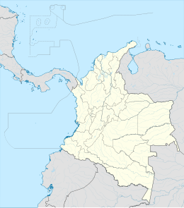
Location in San Andrés y Providencia Location off Colombia | |
| Geography | |
| Location | Caribbean Sea |
| Coordinates | 15°50′N 79°50′W / 15.833°N 79.833°W [1] |
| Total islands | 4 |
| Major islands | Beacon Cay |
| Administration | |
| Department | San Andrés and Providencia |
| Claimed by | |
| Demographics | |
| Population | 0 |
Serranilla Bank (Spanish: Isla Serranilla, Banco Serranilla and Placer de la Serranilla)[2] is a partially submerged reef, with small uninhabited islets, in the western Caribbean Sea. It is situated about 350 kilometres (220 mi) northeast of Punta Gorda, Nicaragua, and roughly 280 kilometres (170 mi) southwest of Jamaica.[1] The closest neighbouring land feature is Bajo Nuevo Bank, located 110 kilometres (68 mi) to the east.
Serranilla Bank was first shown on Spanish maps in 1510. It is administered by Colombia as part of the department of San Andrés and Providencia.[3][4] The reef is subject to a sovereignty dispute involving Colombia and the United States. A previous claim by Honduras was resolved in favor of Colombia when the two countries approved a treaty establishing their maritime boundaries.[5] Jamaica's claim was resolved when it established a joint regime area with overlapping maritime boundaries in 1993, but acknowledging Colombian control of Serranilla and Bajo Nuevo banks.[6] In 2012, in regards to Nicaraguan claims to the islands, the International Court of Justice (ICJ) upheld Colombia's sovereignty over the bank. However, the judgment does not analyze or mention the U.S. claim over the reef.[7]
- ^ a b Sailing Directions (Enroute), Caribbean Sea (PDF). Vol. II (7th ed.). National Geospatial-Intelligence Agency. 2001. p. 95.
- ^ Derrotero de las islas Antillas y de las costas orientales de América p. 333
- ^ (in Spanish) Armada de la República de Colombia: Forces and Commands — area is under the jurisdiction of Comando Específico de San Andrés y Providencia.
- ^ "Mapa Oficial Fronteras Terrestriales y Maritima Convenciones" (PDF). Instituto Geográfico Agustín Codazzi. Retrieved 2009-10-25.[permanent dead link] An official map of Colombian borders, with treaty dates.
- ^ "Maritime Delimitation Treaty between Colombia and Honduras" (PDF). U.N. Delimitation Treaties InfoBase. 1986-08-02. Retrieved 2023-05-27.
- ^ Diemer, Christian; Šeparović, Amalija (2006). "Territorial questions and maritime delimitation with regard to Nicaragua's claims to the San Andrés Archipelago" (PDF). Zeitschrift für ausländisches öffentliches Recht und Völkerrecht. 66: 167–186.
- ^ International Court of Justice (2012). "Territorial and maritime dispute (Nicaragua vs Colombia)" (PDF). Retrieved 2012-11-27.


